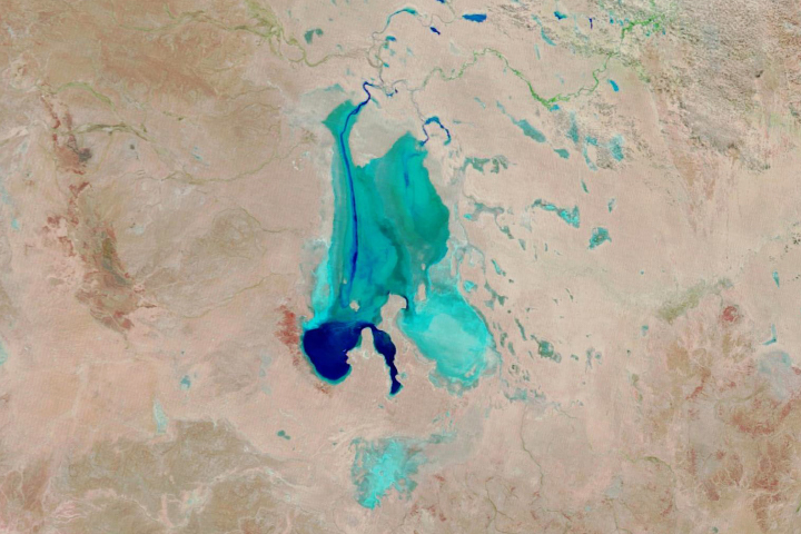
The Great Salt Lake of northern Utah is a remnant of glacial Lake Bonneville that extended over much of present-day western Utah and into the neighboring states of Nevada and Idaho approximately 32,000 to 14,000 years ago. The north arm of the lake, displayed in this astronaut photograph from April 30, 2007, typically has twice the salinity of the rest of the lake due to impoundment of water by a railroad causeway that crosses the lake from east to west. The causeway restricts water flow, and the separation has led to a striking division in the types of algae and bacteria found in the north and south arms of the lake.
Published Jul 16, 2007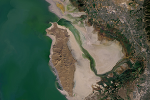
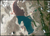
In October 2016, one of America’s largest lakes reached its lowest level on record.
Published Nov 3, 2016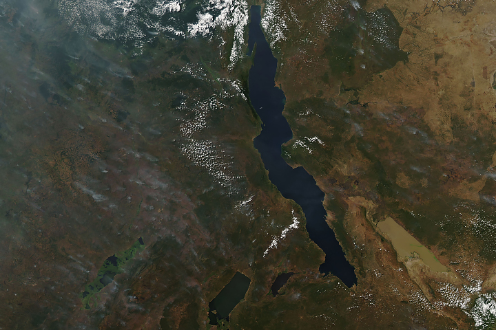
Long and short. Deep and shallow. Salty and fresh. Blue and brown. These are Africa’s Lake Tanganyika and Lake Rukwa.
Published Jun 20, 2019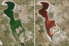
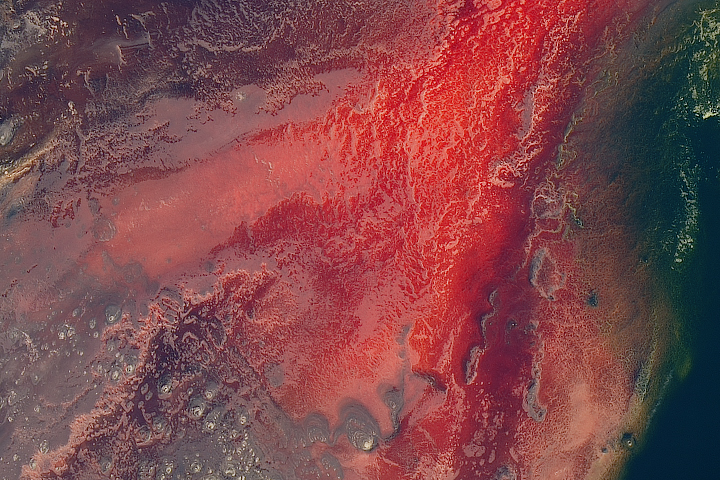
When the water gets saltier in Iran’s largest lake, the microscopic inhabitants can turn the water dark red.
Published Jul 26, 2016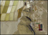
Great Salt Lake serves as a striking visual marker for astronauts orbiting over North America. A sharp line across its center is caused by the restriction in water flow from the railroad causeway. The eye-catching colors of the lake stem from the fact that Great Salt Lake is hypersaline, typically 3–5 times saltier than the ocean, and the high salinities support sets of plants and animals that affect the light-absorbing qualities of the water. Space Station astronauts have recorded the decline in lake levels in response to a regional 5-year drought taking both detailed views and broad views of the entire lake. As lake levels have declined the salt works have become islands in the middle of a dry lakebed.
Published Jan 19, 2004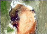

Floodwaters have worked their way through a series of parched channels, watering holes, and lagoons to start filling the iconic Australian lake.
Published May 28, 2019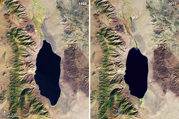
Like this lake in northwestern Nevada, many of the world’s prominent salt lakes are drying up.
Published Apr 4, 2018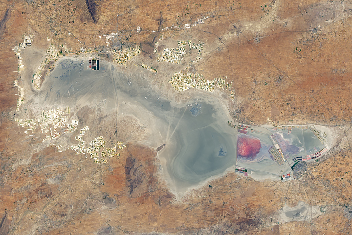
The wet and dry seasons bring two distinct but colorful looks to this wetland in the Thar Desert.
Published Jun 14, 2019Image of the Day Land Water Drought Floods Severe Storms Temperature Extremes
This shallow, saline lake in Iran is one of the largest in the Middle East. But drought and water withdrawals for farming are shrinking it.
Published Aug 4, 2014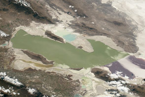
The lake and surrounding landscape are characterized by many flavors and mixtures of salt.
Published Feb 1, 2016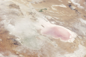
Lake Eyre did something in 2011 that it doesn’t do very often: it took on new water.
Published Dec 19, 2011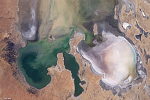
By mid-June 2009, the rare filling of this lake in Australia’s Simpson Desert appeared to have reached its peak.
Published Jun 21, 2009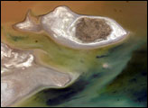
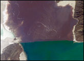
Lake Poopó sits high in the Bolivian Andes, catching runoff from its larger neighbor to the north—Lake Titicaca (not shown)—by way of the Desaguadero River, which is the muddy area at the north end of the lake. Because Lake Poopó is very high in elevation (roughly 3,400 meters, or 11,000 feet above sea level), very shallow (generally less than 3 meters, or 9 feet), and the regional climate is very dry, small changes in precipitation in the surrounding basin have large impacts on the water levels and area of Lake Poopó. When the lake fills during wet periods, it drains from the south end into the Salar de Coipasa salt flat (not shown). Water levels in Lake Poopó are important because the lake is one of South America’s largest salt-water lakes, making it a prime stop for migratory birds, including flamingoes.
Published Apr 24, 2006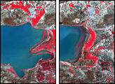
The lake is mostly inhospitable to life, except for a few species adapted to its warm, salty, and alkaline water.
Published May 8, 2017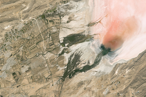
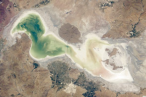
Salt and algae lend color to the bed of this desert lake in Iran.
Published Feb 20, 2017
In May 2016, the reservoir behind Hoover Dam reached its lowest level since the 1930s.
Published May 27, 2016
Satellite data suggests this Russian salt lake is getting brighter due to the installation of check dams.
Published Dec 3, 2014
The largest freshwater lake in Mongolia is known as the “sister” to Lake Baikal. Together they hold 20 percent of the fresh water on the planet.
Published Dec 18, 2017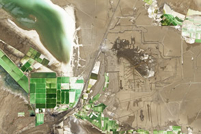
A rim of crystal salts surrounds Lake Qarhan, the largest salt lake playa in China and a significant source of minerals, including table salt and potassium for fertilizer.
Published Feb 2, 2014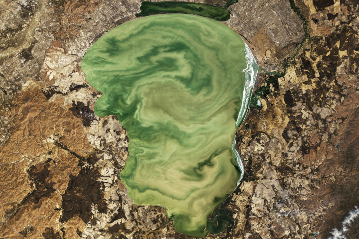
Located on the border of Russia and China, Lake Khanka plays an important role in supporting biodiversity in the region.
Published Jun 10, 2019
Surging with fresh water from heavy winter snow melt, Lake Powell rose significantly in the summer of 2011 after many years of low levels.
Published Aug 12, 2011