What happens downriver can be largely affected by what happens upriver in the floodplains of major rivers.
Published Mar 15, 2018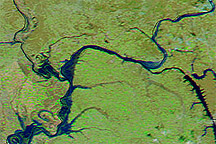
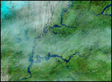
Acquired March 12, 2011, and February 12, 2011, these false-color images show parts of the Ohio and Mississippi Rivers before and after melting snow raised water levels.
Published Mar 14, 2011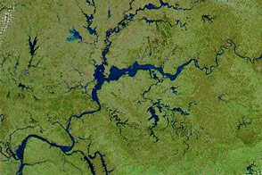
Heavy rainfall and melting snow, plus some ice jams, raised rivers to their highest stages in nearly 20 years.
Published Mar 20, 2015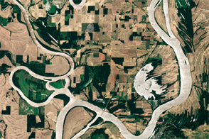
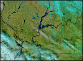
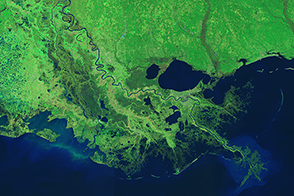
Acquired June 23, 2011, this natural-color image shows the Wabash-Ohio confluence after 2011 spring floods retreated.
Published Jul 3, 2011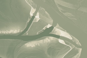
This model of the land elevation between the Mississippi, the Atchafalaya, and the Old River show the uphill fight to control river flow.
Published Jun 4, 2011
Heavy rain and snow swelled the rivers of Indiana, Illinois, and Kentucky, pushing many past flood stage during the first two weeks of January 2005. The flooding occurred after several days of rain and snow fell on the already saturated ground of the U.S. Midwest. Since the water could not be absorbed into the soaked ground, it ran off as flood water. The storms were followed by warm temperatures, which melted the snow and produced further flooding. By January 17, some of the flooding had started to recede, but large tracts of land along the Ohio and Wabash Rivers were still under water.
Published Jan 19, 2005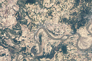
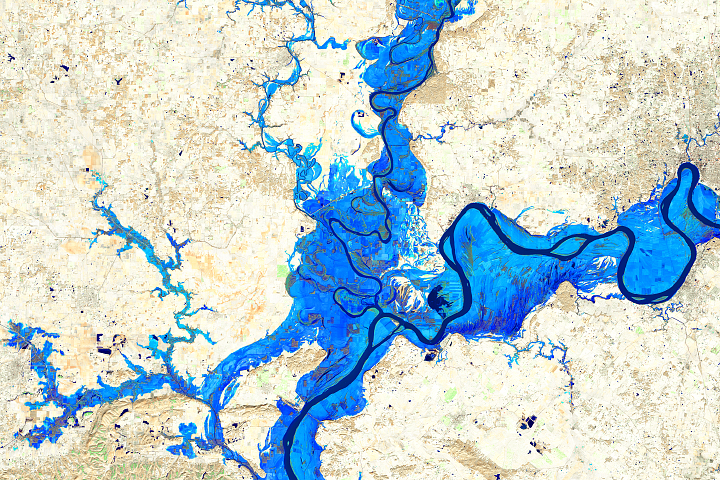
Acquired June 4, 2011, and May 3, 2011, these natural-color images compare flooded and post-flood conditions at the confluence of the Wabash and Ohio Rivers.
Published Jun 7, 2011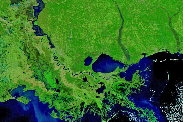
Persistent heavy rains in the first two months of 2020 have swelled rivers from Missouri to the Gulf of Mexico.
Published Feb 29, 2020Image of the Day Land Water Floods Severe Storms Human Presence Remote Sensing
Engineers use levees, floodways, dams, and much more to control the ever restless Mississippi.
Published Mar 18, 2015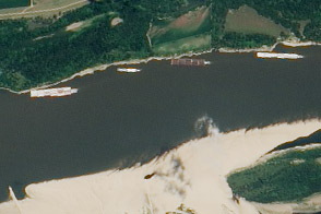
The drought of 2012 reduced traffic to one towboat at a time; groundings closed parts of the river for hours to days.
Published Aug 23, 2012