Cool rain and runoff, combined with the overturning of sea water, has cooled off the sea.
Published Sep 3, 2017Image of the Day Water Severe Storms Human Presence Remote Sensing
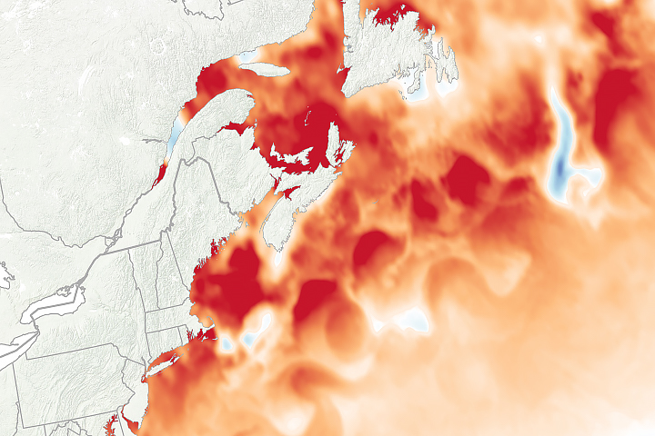
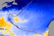
Extreme water temperatures in 2018 fit with a much longer trend in the region, which is among the fastest-warming parts of the global ocean.
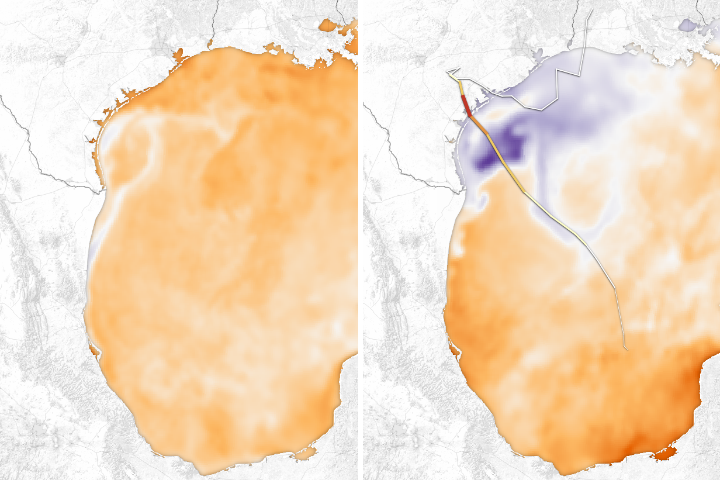
Published Sep 12, 2018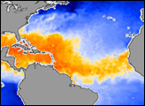
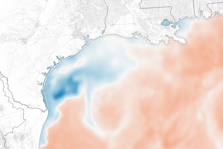
The huge pulse of rainwater and the churning effect of the storm on the Gulf of Mexico has dramatically lowered sea surface temperatures.
Published Aug 31, 2017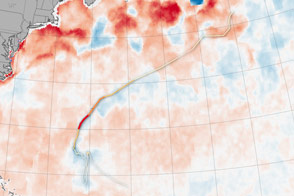
Hurricanes feed off of warm ocean surfaces, consuming the heat and dragging up cool water from below.
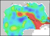
Published Oct 19, 2016
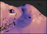
On land, the passage of a severe storm might be marked by fallen trees or swollen streams. In the ocean, a hurricane leaves a swath of cold water in its path. That trail of cold water marks the passage of Hurricane Bertha through the North Atlantic Ocean in this sea surface temperature image.
Published Jul 26, 2008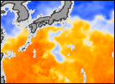
In the winter, strong winds drive surface waters away from the shore, and cold water from the deep ocean wells up to replace it.
Published Jan 8, 2005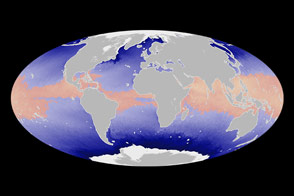
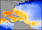
Satellite measurements of sea surface temperatures provide clues to the potential for tropical cyclone development.
Published Jun 4, 2014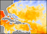
This image of sea surface temperature was acquired by the AMSR-E instrument aboard NASA’s Aqua satellite on September 6, 2004.
Published Sep 7, 2004