The future of weather monitoring and forecasting just got more colorful and a whole lot clearer.
Published Jan 26, 2017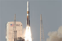
This ground-based photograph shows the GOES-O-bearing Delta IV rocket lifting off from Launch Complex 27 at Cape Canaveral Air Force Station on June 27, 2009.
Published Jul 8, 2009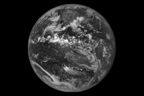
When the GOES-East weather satellite went dark in September 2012, a back-up satellite orbiting nearby sprang into action.
Published Oct 12, 2012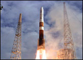
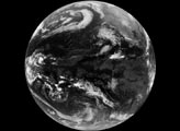
A satellite in a geostationary orbit is in a “sweet spot” in which it orbits at the same speed that Earth rotates.
Published Mar 4, 2018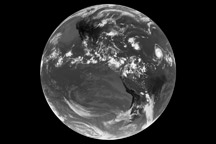
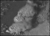
The first full-disk thermal image from the newest NASA/NOAA weather satellite shows the remnants of Tropical Storm Claudette and Tropical Depression Ana, as well as Hurricane Bill on August 17, 2009.
Published Aug 19, 2009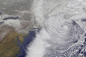
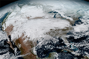
This time-lapse animation shows the merging of two storm fronts into a potent blizzard in February 2013.
Published Feb 13, 2013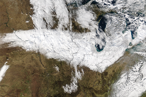
For a region that is quite familiar with snow, it was still a storm for the history books.
Published Nov 24, 2015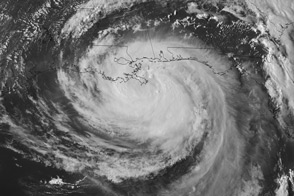
Super rapid scan images of Hurricane Isaac taken from geostationary orbit reveal the movement of clouds at different altitudes.
Published Aug 29, 2012
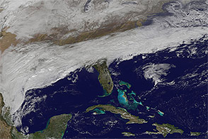
A large frontal system brought snow, ice, and sleet to states that are not usually prepared for such cold winter weather.
Published Feb 11, 2014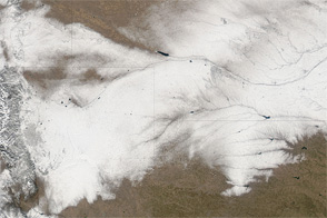
Snow makes a wide track across Colorado, Wyoming, Nebraska, and Kansas in early February 2012.
Published Feb 7, 2012