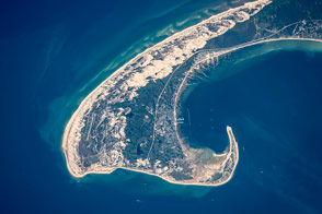
Winds and wave refraction give the area around Provincetown a distinctive hook shape.
Published Aug 31, 2015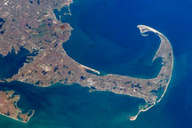
Cape Cod is a haven for rocks and people who have washed up on American shores.
Published Nov 21, 2010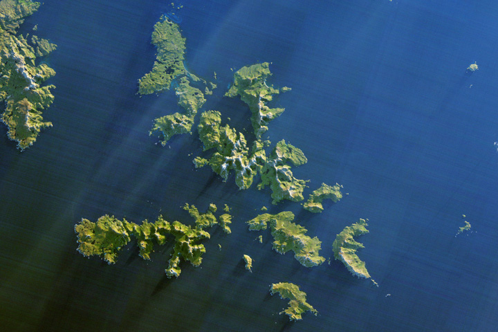
Ferocious winds and huge waves have long made it perilous to navigate around the southernmost tip of South America.
Published Dec 24, 2017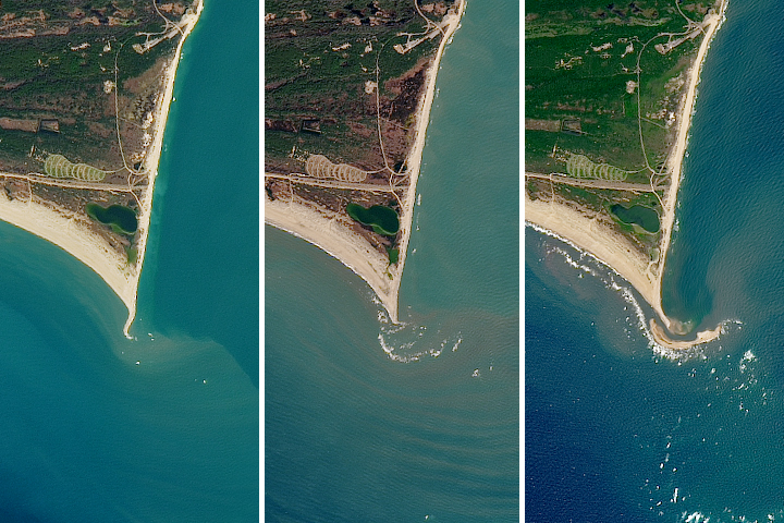
The natural movement of sediment has built up a shoal island off the Outer Banks in North Carolina.
Published Jul 12, 2017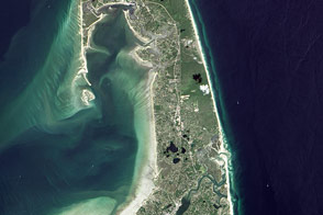
“A man may stand there and put all America behind him.”
Published Nov 25, 2016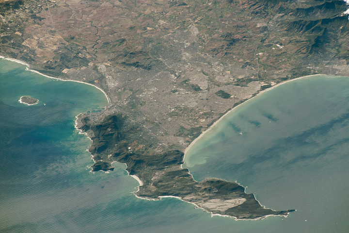
Originally named the Cape of Storms, it was later renamed to Good Hope in order to attract more people to the Cape Sea Route.
Published Aug 18, 2019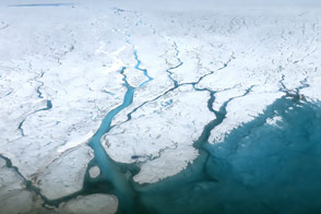
A summer field campaign examines the hydrology of the water streaming across the top of the ice sheet.
Published Aug 30, 2015
The impending birth of a big, new iceberg from Antarctica’s Larsen C Ice Shelf will not have an immediate effect on sea level, but it could be an indicator of future problems.
Published Apr 14, 2017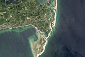
Beaches are dynamic, living landscapes. The coast off of Chatham, Massachusetts, provides a prime example of beach evolution.
Published May 30, 2014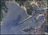
The modern Buzzards Bay is approximately 45 kilometers long by 12 kilometers wide and is a popular destination for fishing, boating, and tourism. The Cape Cod Canal allows for passage between Buzzards Bay and Cape Cod Bay to the northeast; the wakes of numerous pleasure craft appear along the length of the Canal.
Published Aug 29, 2005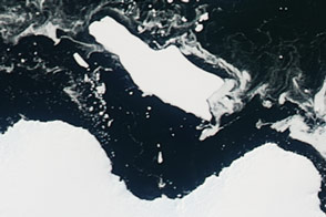
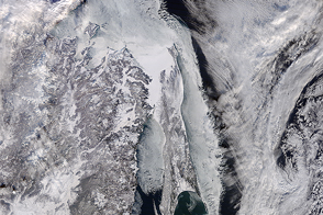
Sea ice in an East Antarctic bay broke up, providing access to Cape Denison for the first time in six years.
Published Mar 4, 2016
The acceleration has been driven mainly by increased ice melting in Greenland and Antarctica, and it has the potential to double the total sea level rise projected by 2100.
Published Feb 20, 2018
New elevation measurements will give researchers an unprecedented understanding of the thickness of sea ice, which will be used to help improve climate modeling and forecasts.
Published Dec 18, 2018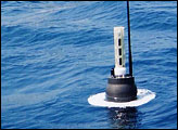
A spectacular view of sea ice was captured during an Operation IceBridge flight in 2014; the mission surveyed ice at both poles again in 2015, this time simultaneously.
Published Oct 4, 2015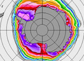
The Sea of Okhotsk is the lowest latitude area where sea ice forms each winter.
Published Jan 11, 2015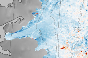
Sections of the Greenland Ice Sheet that end on land are slowing—a sliver of good news for sea level rise.
Published Oct 30, 2015
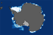
The 2014 arctic sea ice minimum is the sixth lowest on record, while antarctic sea ice continues to exceed the record maximum extent.
Published Sep 24, 2014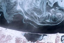
Sea ice formed delicate swirls of blue and white in the Sea of Okhotsk in February 2009.
Published Feb 27, 2009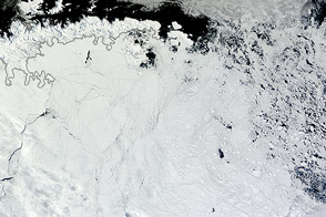
Winds pushed Antarctic sea ice north of its typical location in February 2013.
Published Mar 1, 2013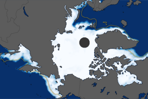
The extent of Arctic sea ice peaked at 15.24 million square kilometers on March 18, 2012. It was the ninth consecutive year of maximum extents below the long-term average.
Published Mar 27, 2012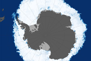
In 2015, the annual maximum extent of Antarctic sea ice dropped below previous consecutive years of record highs.
Published Oct 18, 2015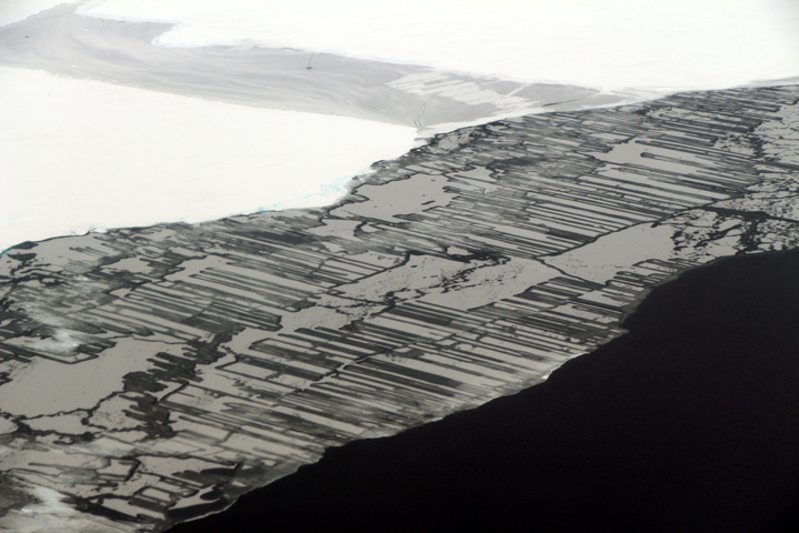
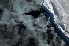
As a result of the collision, blocks of ice slide above and below each other in a pattern that resembles a zipper or interlocking fingers.
Published Nov 22, 2017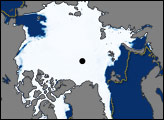
This pair of images shows Antarctic sea ice concentrations at the 2008 winter maximum and the 2009 summer minimum compared to the median ice extent from 1979–2000.
Published May 23, 2009
These maps compare Arctic sea ice minimum extents in 1984 (a year with average coverage) and 2012 (the new record low).
Published Sep 27, 2012