Powder River Basin is a major source of low-sulfur coal, helping to make Wyoming one of the largest coal-producers in the United States.
Published Mar 14, 2016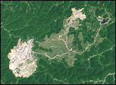
This pair of images shows the growth of a mountaintop removal in the headwaters of Mud River in Boone County, West Virginia, between 1987 and 2002.
Published Dec 23, 2007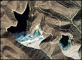
Since the mid- to late 1990s, the number and size of coal mines known as mountaintop removal mines increased dramatically in parts of Virginia, West Virginia, Pennsylvania, and Kentucky. The final step in processing this coal creates sludge that contains coal dust, sediment, and possibly heavy metals and chemicals. Mine operators contain the coal sludge in nearby valleys, behind huge earthen dams known as valley fills.
Published Apr 25, 2008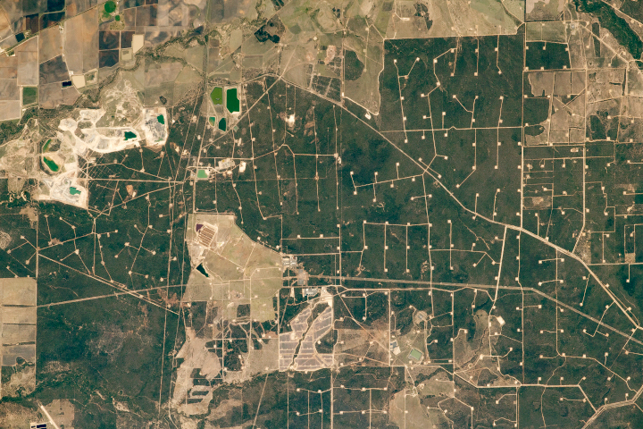
The Surat Basin has 150 million-year-old sediments, four billion tons of proven thermal coal resources, and a bunch of cows.
Published Apr 7, 2019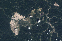
Multiple layers of coal lie underground in ancient rocks. In some places, miners remove mountaintops to get at it.
Published Apr 10, 2011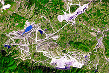
Surface mines and fly-ash deposits in the Tuzla Basin reveal the region’ long history as a coal-production hub for Bosnia and Herzegovina. This image of the altered landscape was captured on September 21, 2003.
Published Apr 28, 2009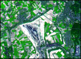
Landsat 5 observed the growth of one of the largest surface mines in the state it expanded from ridge to ridge.
Published Mar 3, 2010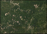
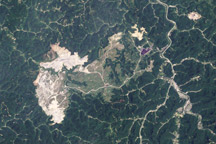
Mountaintop removal mining dramatically changes the topography across thousands of acres. Mountaintop removal mining alters this topography by reducing the elevation of the ridge lines, flattening out the steep slopes, and also by filling in hollows and stream beds with the excess rock and dirt that once topped the mountains.
Published Dec 28, 2007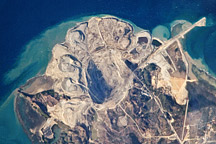
A rare cloud-free photo of the northern end of Semirara Island in the Philippines shows the Panian open-pit mine.
Published Apr 12, 2010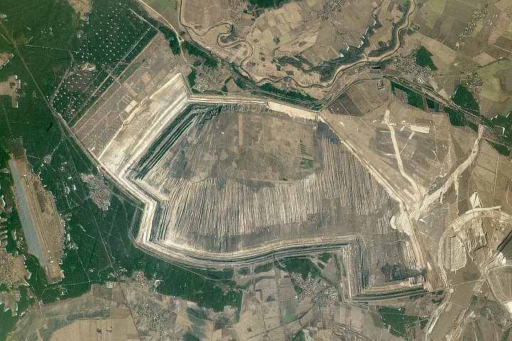
An astronaut managed to capture the size and detail of the artificial landscape that results from strip mining.
Published Jun 26, 2017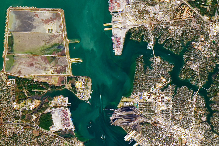
The deep channels through Hampton Roads have made the surrounding cities important hubs of shipping, trade, and defense.
Published Dec 24, 2019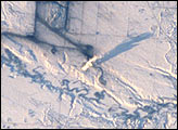
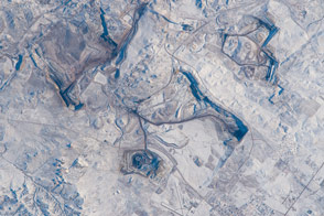
Snow and ice serve to accent human activities in this photograph taken by the Space Shuttle mission STS-98 crewmembers on February 17, 2001. The Souris River stretches across the photograph from left to right, with the upstream Rafferty Dam Reservoir frozen over on the far left. Two power plants, the Boundary Dam Power Station and the Shand Power Station, can be identified by the smoke plumes and shadows of those plumes. The river is frozen over upstream of the Boundary Dam Power Station, but thermal loading from the plants has warmed the water in the Boundary Dam Reservoir so that it remains nearly ice free. Downstream of the reservoirs, thermal loading is sufficient to maintain open flow in the Souris River.
Published Mar 18, 2001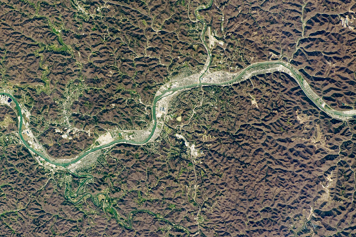
Nestled in a river valley in the Allegheny Mountains, the city first attracted weary travelers, who then stayed for the salt, trees, and coal.
Published Aug 30, 2020
The pit near Phalaborwa and Kruger National Park is the most visible sign of a long history of mining in the region.
Published Jul 30, 2019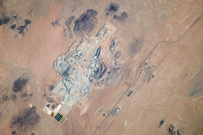
One of Earth’s richest borate deposits is at the center of the largest open-pit mine in California.
Published Nov 11, 2013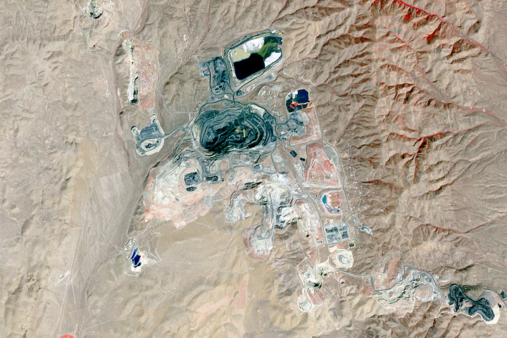
Northeastern Nevada has a geological feature rich with gold.
Published Aug 27, 2017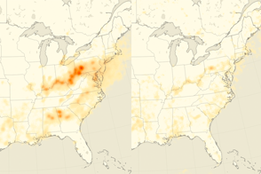
Levels of the air pollutant have dropped by about 80 percent over the eastern United States.
Published Dec 22, 2015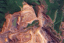
The terraced layers of red earth that make up the Carajás Iron Ore Mine contrast with the deep green Amazon Rainforest in this cloud-free image.
Published Jul 29, 2009