The river drains water and sediment from 31 U.S. states, delivering both to the Gulf of Mexico via the Atchafalaya and Mississippi River deltas.
Published Jul 5, 2019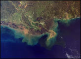
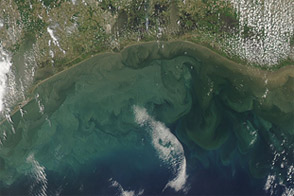
Sediment-laden water pours into the northern Gulf of Mexico from the Atchafalaya River in this photo-like image taken on April 7, 2009.
Published Apr 18, 2009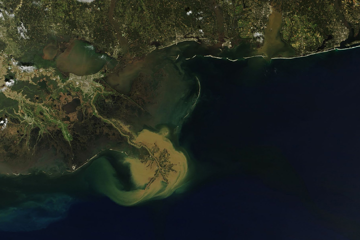
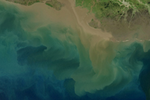
A pulse of flood water from the central United States spilled into the Gulf of Mexico.
Published Mar 9, 2018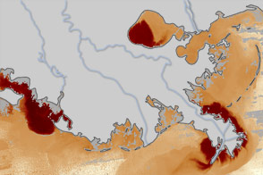
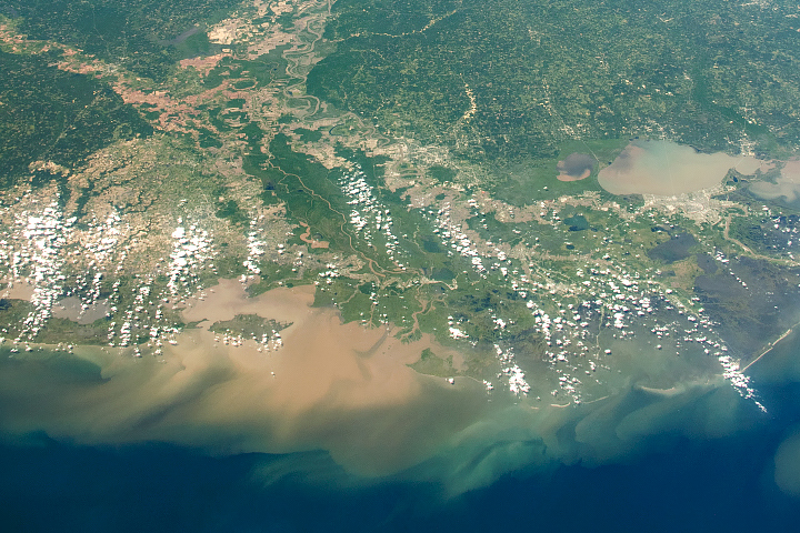
These maps illustrate how much sediment flowed into the Gulf of Mexico during the floods on the Mississippi River in May and June 2011. The nutrient-rich sediment is expected to contribute to the development of a record dead zone this summer.
Published Jun 24, 2011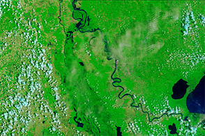
Acquired June 8, 2011, and June 9, 2010, these false-color images compare conditions along the Mississippi and Atchafalaya Rivers in Louisiana.
Published Jun 9, 2011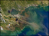
Acquired May 17, 2011, and May 22, 2011, these natural-color images show sediment in the Gulf of Mexico, one consequence of Mississippi River flooding.
Published Jun 23, 2011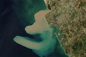
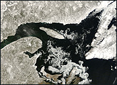
Acquired November 12 and 13, 2012, these images show a sediment plume along Spain’s southwestern coast.
Published Nov 18, 2012
Located in eastern Canada, the Gulf of St. Lawrence owes many of its unique characteristics to its geography. Sea water flows into and out of the gulf through only two channels. Currents and tides sweep cold, Arctic seawater through the narrow Strait of Belle Isle in the north. In the south, the wider Cabot Strait admits warmer water from the Atlantic Gulf Stream. With no other outlet to the Atlantic, the Gulf of St. Lawrence is relatively isolated.
Published Apr 12, 2008
A satellite image offers inky evidence of the organic-rich freshwater that the Suwannee River delivers to the Gulf of Mexico.
Published Oct 27, 2018
Acquired June 1, 2011, and May 28, 2010, these false-color images compare conditions along the Lower Mississippi River.
Published Jun 1, 2011