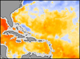
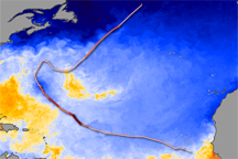
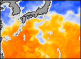
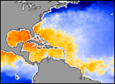
This image of sea surface temperature was acquired by the AMSR-E instrument aboard NASA’s Aqua satellite on September 6, 2004.
Published Sep 7, 2004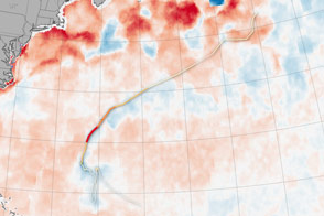
Hurricanes feed off of warm ocean surfaces, consuming the heat and dragging up cool water from below.
Published Oct 19, 2016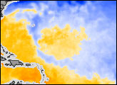
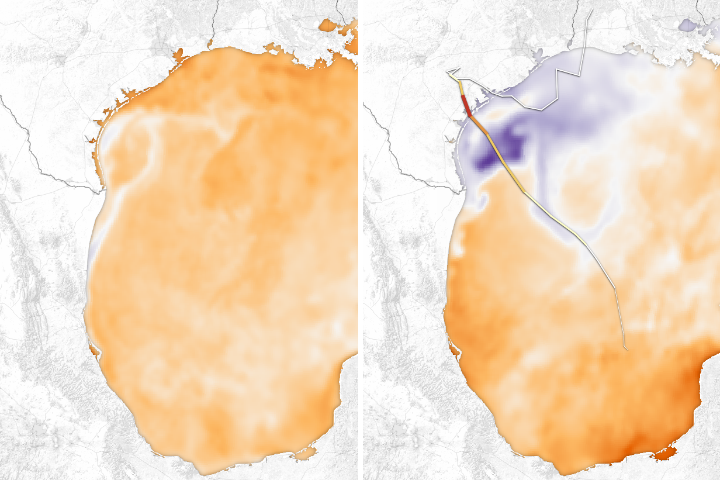
Cool rain and runoff, combined with the overturning of sea water, has cooled off the sea.
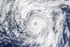
Published Sep 3, 2017Image of the Day Water Severe Storms Human Presence Remote Sensing
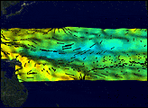
On land, the passage of a severe storm might be marked by fallen trees or swollen streams. In the ocean, a hurricane leaves a swath of cold water in its path. That trail of cold water marks the passage of Hurricane Bertha through the North Atlantic Ocean in this sea surface temperature image.
Published Jul 26, 2008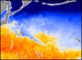
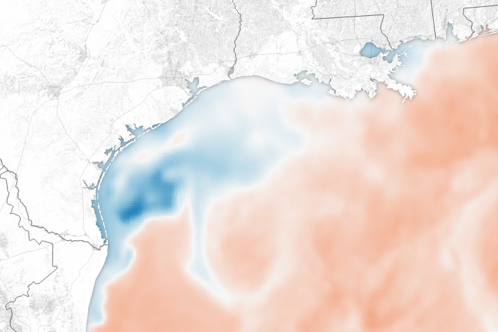
The huge pulse of rainwater and the churning effect of the storm on the Gulf of Mexico has dramatically lowered sea surface temperatures.
Published Aug 31, 2017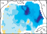
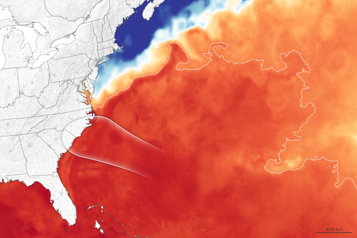
Forecasters expect the major hurricane to get a boost of energy from the Gulf Stream.
Published Sep 13, 2018Image of the Day Atmosphere Water Severe Storms Remote Sensing
Satellite measurements of sea surface temperatures provide clues to the potential for tropical cyclone development.
Published Jun 4, 2014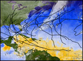
The 2005 Atlantic Hurricane season broke record after record: most named storms, lowest pressure measured in the Atlantic, longest-lived December hurricane, and the list goes on. This image provides a summary of the season, with the track of each named storm marked in black. In all, 30 tropical depressions, tropical storms, and hurricanes formed in 2005. Of these, 26 were named storms, a status given to tropical storms and hurricanes.
Published Dec 17, 2005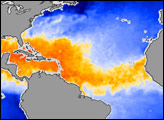
Alex is the earliest hurricane in the North Atlantic since 1938, and one of the farthest northeast on record.
Published Jan 15, 2016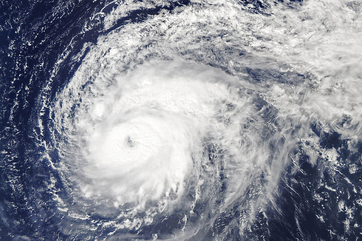
Though it has weakened since reaching category 5 strength, the hurricane is still bringing heavy rain and strong winds to the northeast Atlantic.
Published Oct 2, 2019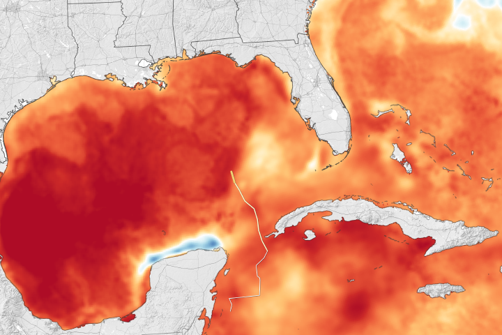
The U.S. state that receives more direct hits from hurricanes than any other prepared for yet another one.
Published Oct 10, 2018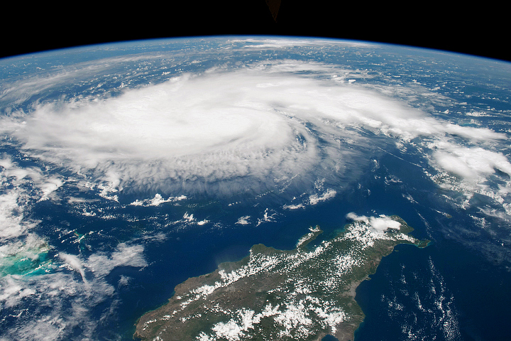
Heading into Labor Day weekend, citizens and government officials braced for a potent hurricane that has been intensifying in the tropical Atlantic Ocean.
Published Aug 30, 2019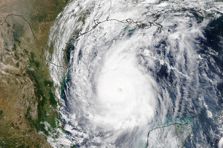
After making landfall on the Yucatan Peninsula, the category 2 storm was strengthening over warm waters.
Published Oct 8, 2020Image of the Day Heat Land Water Severe Storms Human Presence
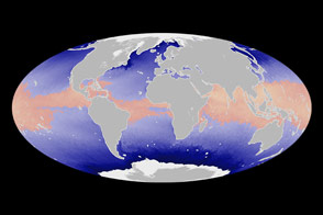
La Niña, the large area of cold water in the Pacific Ocean widely blamed for last summer's drought and often related to an increase in the number of hurricanes that make landfall, appears to be on its last legs.
Published May 10, 2000