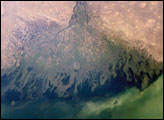
The Volga River drains much of western Russia’s industrial region as it travels southward to empty into the Caspian Sea. Over thousands of years, the river has built a tremendous delta that forms the northwestern shoreline of the Caspian Sea. The delta channels provide transportation between the heartland of Russia and the oil-rich Caspian Sea. The Volga’s extensive distributaries (branches to the sea) harbor habitat and rich fishing grounds for Russia’s famous beluga sturgeon, the source of beluga caviar. The delta’s wetlands, parts of which are designated as the Astrakhanskiy Biosphere Reserve, are important stopping points and breeding grounds for migrating water birds. This detailed astronaut photograph zooms in on a shipping channel in the western part of the delta.
Published Oct 23, 2006
In the past few centuries, a river in northwestern Canada stopped wandering and assumed a more direct route to the sea.
Published Sep 4, 2012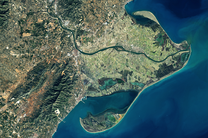
Spain's Ebro Delta has recently experienced tremendous shape-shifting.
Published Mar 13, 2018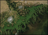
Chinese engineers changed the main channel through the delta, changing the shape of the land at the river’s mouth.
Published Jan 27, 2010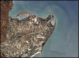
The Ebro River Delta, located along the eastern coast of Spain, is one of the largest wetland areas in the western Mediterranean region.
Published Jul 26, 2004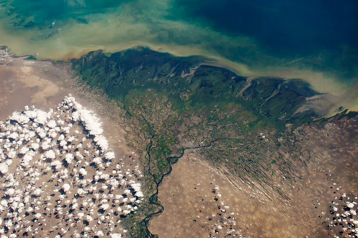
The Volga Delta has grown significantly over the past 130 years.
Published Nov 12, 2018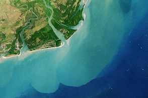
One of Africa’s largest river systems reaches the Indian Ocean with less water and sediment today than in the past.
Published Dec 12, 2013
This elevation image shows that the Irrawaddy Delta in Burma (Myanmar) is clearly flat, much of it below five meters in elevation. This low elevation makes the delta particularly prone to flooding from storm surges.
Published Sep 22, 2009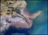
The Yellow River Delta coastline along the Gulf of Bohai has always experienced dramatic changes, and those changes continue today. This mosaic of images taken by astronauts aboard the International Space Station shows several things. First, the image shows today’s configuration of the delta of China’s Yellow River, which is one of the most dynamic coastlines on Earth. Second, the scene allows mapping of land use along the coastal plain, including the boundaries of the Shengli Oil Field, China’s second largest oil field. But perhaps the most interesting aspect of this image is the large patch of green water off the northern coast of the delta—a presumed plankton bloom.
Published Aug 23, 2004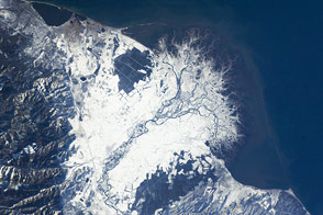
The Selenga River Delta, which stretches out into Russia’s Lake Baikal, is carved by an intricate network of channels and levees and surrounded by marshlands.
Published Nov 28, 2011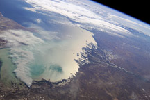
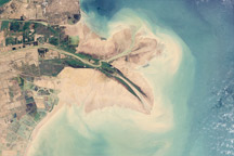
Astronauts on the International Space Station took in this view of the north coast of the Caspian Sea and two river deltas in Kazakhstan and Russia on September 11, 2010.
Published Sep 27, 2010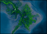
Time, weather, and human intervention have all shaped the Mississippi Delta in Louisiana, a giant bird’s foot shape protruding into the Gulf of Mexico. The Mississippi River deposits sediment into the ocean, and over 25 years, NASA Landsat satellites observed changes in the delta’s shape.
Published Oct 7, 2007