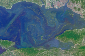
Freshened surface water and abundant nutrients lead to an explosion of algae in the inland sea.
Published May 31, 2015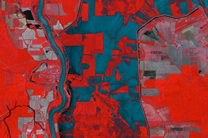
The ASTER instrument on NASA’s Terra satellite captured this false-color image of the Morganza Floodway on May 18, 2011.
Published May 20, 2011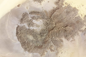
Rising from Sahara sands, the uneven peaks hold clues to a much wetter environment in the ancient past.
Published Mar 9, 2013
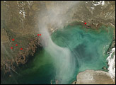
A hazy plume drifted over the northern end of the Caspian Sea in early April 2008. The translucent plume swirling over the water contrasts with the nearby opaque white clouds. The plume might result partly from smoke from springtime agricultural fires in farmland north of the sea.
Published Apr 16, 2008

Acquired May 11, 2011, and April 21, 2007, these false-color images show the Mississippi River near Natchez, Mississippi. The image from May 2011 shows flooded conditions.
Published May 13, 2011
The lowest spot on dry land, the Dead Sea depression sinks 400 meters (1,300 feet) below sea level.
Published Nov 12, 2006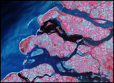
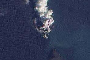
An eruption and an apparent new island appeared in the Red Sea in December 2011.
Published Dec 28, 2011