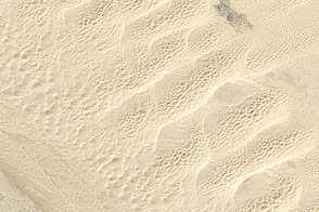
This detailed true-color image from February 24, 2011, shows the variety of sand dunes that make up the Algodones Dunes in southeastern California.
Published May 27, 2011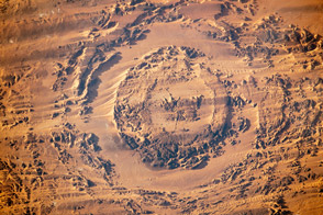
Photographs taken by astronauts on the ISS in 2003 and 2013 show the evolution of a dune field in Chad.
Published Dec 9, 2013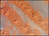
Winds shape the sands that were left behind by an ancient river.
Published Jun 4, 2012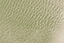
This digital elevation map of the Badain Jaran Desert shows multi-generation dunes, with smaller dunes resting atop larger ones.
Published Apr 20, 2011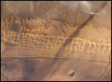
Fans of the Star Wars series of films may recognize the Algodones Dunefield—also known as the Imperial Dunes—as portions of the imaginary planet of Tatooine. While not planetary in scale, this dunefield located at the junction of three states (Arizona and California in the United States; Baja California del Norte in Mexico) is a distinctive feature of North America. The field is approximately 72 kilometers long by 10 kilometers wide (45 miles by 6 miles) and extends along a northwest-southeast line that correlates to the prevailing northerly and westerly wind directions. The dune field is a wilderness area, with the only human structure being the All American Canal that cuts across the southern portion from west to east (right side of view). A checkerboard pattern of farms in the Colorado River flood plain is visible on the Mexican side of the border (far right). Wisps of cloud obscure the Cargo Muchacho Mountains (top).
Published Nov 21, 2005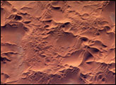
he Issaouane Erg (sand sea) is located in eastern Algeria between the Tinrhert Plateau to the north and the Fadnoun Plateau to the south. Considered to be part of the Sahara Desert, the Issaouane Erg covers an area of approximately 38,000 km2. These complex dunes form the active southwestern border of the sand sea.
Published Feb 7, 2005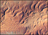
One of the main reasons that rainless regions like the Sahara Desert are interesting from the perspective of landscape science is that the work of flowing water—mainly streams and rivers—becomes less important than the work of wind. Over millennia, if enough sand is available, winds can generate dunes of enormous size, arranged in regular patterns. Long, linear dunes stretch generally north to south across much of northeast Algeria, covering a vast tract (~140,000 square kilometers) of the Sahara Desert known as the Erg Oriental. Erg means “dune sea” in Arabic, and the term has been adopted by modern geologists. Spanning this image from a point on the southwest margin of the erg (image center point: 28.9°N 4.8°W) are a series of 2-kilometer-wide linear dunes, comprised of red sand. The dune chains are more than 100 meters high. The “streets” between the dunes are grayer areas free of sand.
Published Sep 11, 2006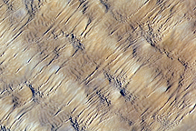
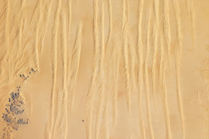
Layers of dunes march across a sand sea in the east-central Tenéré Desert of Niger in this astronaut photo from December 1, 2009.
Published Dec 28, 2009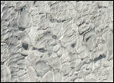
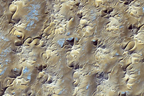
Complex wind patterns left these distinctive star-shapes in the sands of the Grand Erg Oriental.
Published Sep 29, 2013