Acquired September 9, 2011, these images provide two views of the Bear Creek Fire burn scars in northeastern Texas.
Published Sep 12, 2011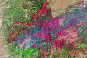
The Whitewater-Baldy Fire is the largest on record in New Mexico.
Published Jun 14, 2012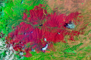
The EO-1 satellite observed the burn scar from the Little Bear Fire.
Published Jun 14, 2012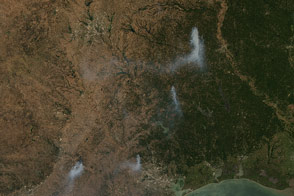
Acquired September 6, 2011, this natural-color image shows fires burning around Dallas and Houston, Texas, and Shreveport, Louisiana.
Published Sep 7, 2011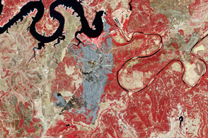
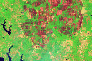
Acquired September 3, 2011, this false-color image shows the burn scar from the 101 Ranch Fire in Palo Pinto County, Texas.
Published Sep 7, 2011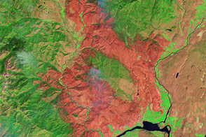
The largest fire in Washington’s state history charred tens of thousands of acres and destroyed 322 homes in summer 2014.
Published Aug 13, 2014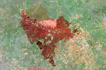
This Landsat-5 image shows the land burned in the Cooper Mountain Ranch Fire in central Texas.
Published May 2, 2011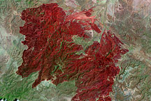
This Landsat image, taken on May 2, 2011, shows all 314,444 acres burned in the Rockhouse Fire in southwestern Texas.
Published May 5, 2011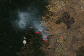
These images show the extent of wildfires burning in the Cascade Mountains southeast of Portland, Oregon.
Published Sep 2, 2011
Burn scars dot the state of Texas in this image from April 30, 2011.
Published Apr 27, 2011
The Landsat-5 satellite acquired this image of the Swenson Fire burn scar on April 18, 2011.
Published Apr 27, 2011