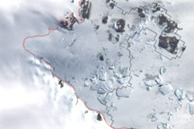
This image shows the latest estimate of the ice edge around Law Promontory, which juts out from East Antarctica’s coastline near Stefansson Bay.
Published Jul 23, 2010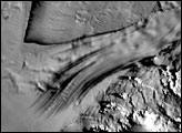
A slab of ice larger than the continental United States smothers much of East Antarctica. Draining from the East Antarctic Ice Sheet is a river of ice nearly 800 kilometers long. This stream, the Recovery Ice Stream, slides roughly 35 billion tons of ice into the ocean each year.
Published Apr 26, 2007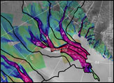
The image above depicts the region of West Antarctica where scientists measured ice speed. The fast-moving central ice streams are shown in red. Slower tributaries feeding the ice streams are shown in blue. Green areas depict slow-moving, stable areas. Thick black lines depict the areas that collect snowfall to feed their respective ice streams.
Published Jan 25, 2002
Researchers working in Antarctica have found evidence of large-scale ice making at the bottom of that continent's massive ice sheets.
Published Apr 21, 2011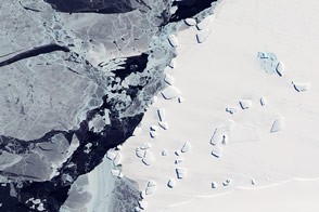
Acquired October 7, 2011, this natural-color image shows an ice menagerie off the coast of East Antarctica.
Published Oct 23, 2011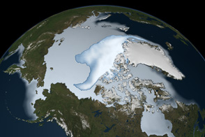
Thick ice that used to last through multiple summers has been in steep decline for three decades.
Published Mar 1, 2012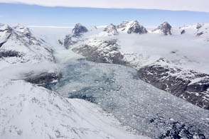
NASA aircraft return to the Arctic to assess the health of the region’s ice.
Published May 3, 2012
This approximately true-color image shows ice fragments left over from previous breakups of the Wilkins Ice Shelf.
Published Apr 19, 2009
In 1984, there were 1.86 million square kilometers of old ice spread across the Arctic at its yearly minimum extent. In September 2016, there were only 110,000 square kilometers of old ice left.
Published Nov 4, 2016
To the untrained eye, Antarctica may look like a giant piece of solid ice that rarely changes, but scientists studying the continent have long known better. The icy surface is dynamic, with glaciers and "streams" of ice flowing toward the ocean.
Published Apr 27, 2007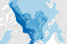
This pair of maps shows how the sea ice covering the Arctic at winter maximum in 2009 is younger than it was in the past.
Published Apr 10, 2009