Acquired August 30, 2011, and June 23, 2011, these false-color images show changes to part of the Ganga, or Ganges, River.
Published Aug 31, 2011
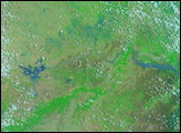
Acquired on July 18 and August 1, 2009, these false-color images provide a before-and-after view of the Sitamarhi District of the Indian state of Bihar. The image from August 1 shows swollen waterways and large areas of standing water.
Published Aug 3, 2009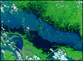
Acquired August 2, 2011, and March 6, 2011, these false-color images compare conditions along part of the Irrawaddy River in Burma, which rises substantially during the summer monsoon.
Published Aug 5, 2011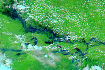
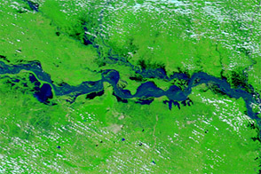
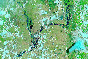
These false-color images show the difference in rivers and floodplains in the Indian state of Bihar in Mid-July and late August 2009.
Published Aug 31, 2009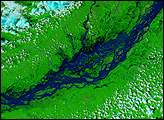
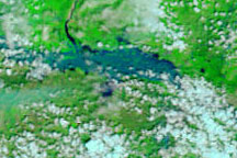
These false-color images show a portion of the Krishna River in southern India in flood stage on October 5, 2009 (top), and before the flooding on September 10, 2009 (bottom).
Published Oct 5, 2009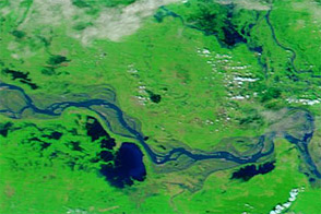
Acquired October 8, 2011, and October 10, 2010, these false-color images compare conditions along a stretch of the Ganga (Ganges) River, where flooding struck in 2011.
Published Oct 10, 2011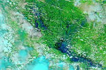
Acquired July 23 and August 24, 2009, these false-color images show swollen rivers along the India-Nepal border. The Ganges and Ghaghara Rivers are both swollen.
Published Aug 26, 2009