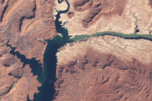
In the early twenty-first century, Lake Powell faced the combined threats of drought and rapid water withdrawals.
Published May 13, 2009

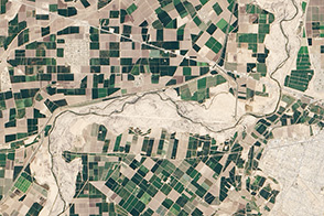
Natural vegetation and irrigated farmland along the Snake River Plain in Idaho use dramatically different amounts of water during the growing season.
Published Jan 26, 2010
An arid region grew even drier between 2003 and 2009 due to human consumption of water for drinking and agriculture.
Published Mar 13, 2013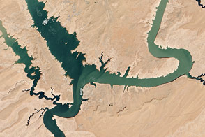
In spring 2014, visitors to Lake Powell will find beaches and rock formations that are usually underwater. After several years of drought, the reservoir has dropped below 50 percent capacity.
Published May 22, 2014
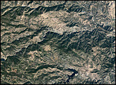
For more than 100 years, groups in the western United States have fought over water. During the 1880s, sheep ranchers and cattle ranchers argued over drinking water for their livestock on the high plains. In 1913, the city of Los Angeles began to draw water away from small agricultural communities in Owen Valley, leaving a dusty dry lake bed. In the late 1950s, construction of the Glen Canyon Dam catalyzed the American environmental movement. Today, farmers are fighting fishermen, environmentalists, and Native American tribes over the water in the Upper Klamath River Basin. The Landsat 7 satellite, launched by NASA and operated by the U.S. Geological Survey, documented an extreme drought in the area along the California/Oregon border in the spring of 2001.
Published Sep 8, 2001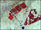
A one-time pulse of water is bringing a burst of new life to the lower Colorado River.
Published May 1, 2014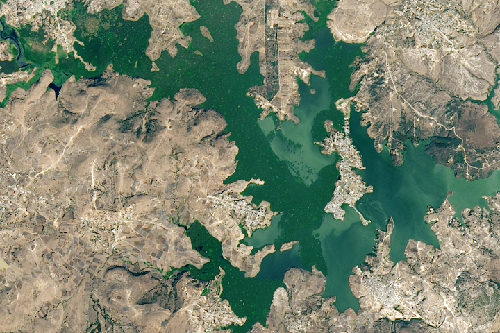
A new study found that the abundance of these floating plants has increased due to urbanization.
Published Sep 2, 2020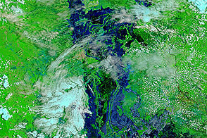
Acquired August 24, 2011, and August 26, 2010, these false-color images compare conditions in Cambodia. Flooding occurred along the Mekong River, Tônlé Sab, and around Phnum Penh in 2011.
Published Aug 29, 2011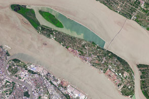
The fast-growing city has polluted waterways and a growing demand for clean tap water.
Published Apr 11, 2017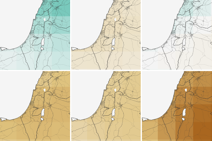
Water shortages in the Middle East lead to sanitation issues in schools, resulting in periodic school closures. NASA is working to change that.
Published Jul 27, 2018
Ongoing drought and diminished snowpack in the Rockies have combined with increasing demands downstream to cause the great reservoir to drop to historically low levels.
Published Aug 1, 2014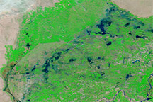
Acquired on February 21, 2011, and February 23, 2010, these false-color images show water levels along the Indus River before and after the monsoon floods that struck Pakistan in 2010.
Published Feb 25, 2011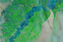
Acquired August 8,10, and 12, 2010, these false-color images show a substantial rise in water levels on the Indus River downstream from Sukkur, Pakistan.
Published Aug 12, 2010