This vegetation map reveals the impact severe drought was having on plants in Texas in April 2011.
Published Apr 27, 2011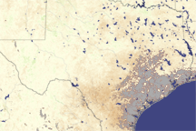
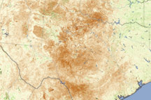
Most of Texas is brown in this vegetation index image, revealing the negative impact drought had on plants in August 2009.
Published Aug 12, 2009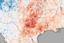
This temperature map shows the extremely warm temperatures that helped create hazardous fire conditions in Texas in April.
Published Apr 22, 2011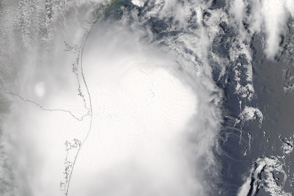
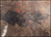
Tropical Storm Don was approaching southwestern Texas when this true-color image was taken on July 30, 2011.
Published Jul 31, 2011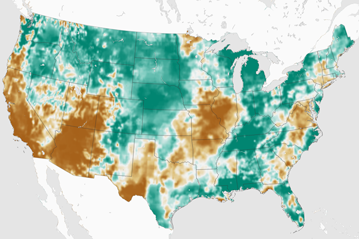
By late February 2018, an estimated 55 percent of the continental U.S. was classified as abnormally dry.
Published Mar 2, 2018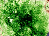
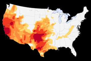
Severe to extreme drought persists in the Southwest and the Plains in May 2014.
Published May 13, 2014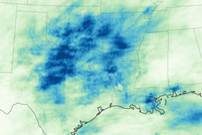
After years of drought, Texas, Oklahoma, and other states are now coping with persistent flooding rains.
Published May 22, 2015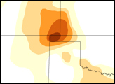
The U.S. Drought Monitor reports its lowest levels in 17 years.
Published May 5, 2017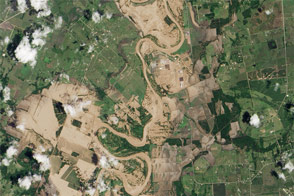
The Brazos River reached record-high water levels west of Houston.
Published Jun 3, 2016Image of the Day Land Water Floods Severe Storms Human Presence
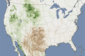
Extreme heat helped push as much as 26 percent of the contiguous United States into drought in July 2011. This image shows the impact on plants throughout the month.
Published Aug 11, 2011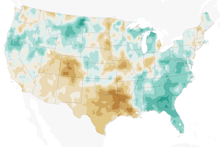
Temperatures across much of the region in 2018 have been well above the norms, while precipitation has been well below—a recipe for struggling farmers and concerned forest fire managers.
Published Jun 12, 2018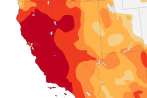
More than 64 million people are directly affected by drought in the Southwest and Southern Plains, and far more are indirectly affected because of the vast number of farms, orchards, and ranches that supply the rest of the United States.
Published Nov 27, 2014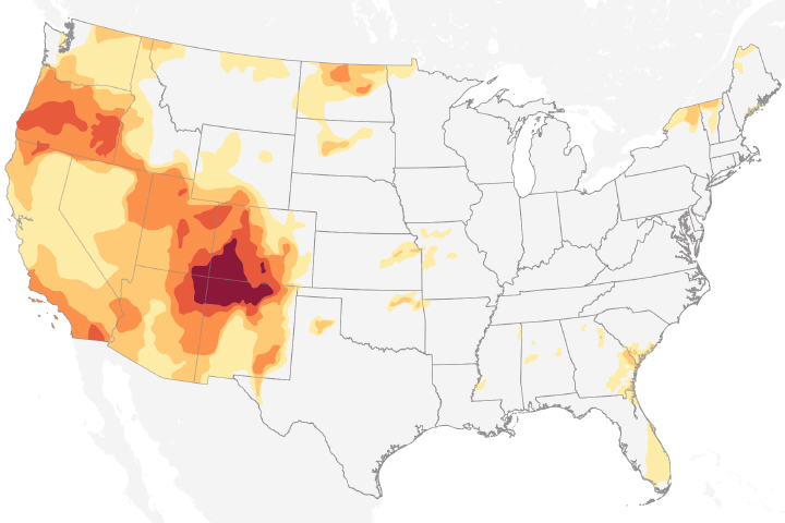
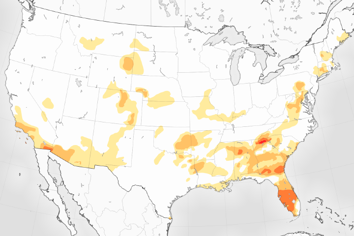
Drought conditions in 2018 are extreme over the Four Corners region of the United States.
Published Nov 8, 2018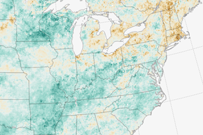
A dry summer is giving farmers in the Northeast one of their toughest seasons in years.
Published Sep 13, 2016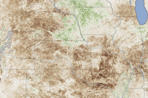
In a dry spell of historic proportions, more than half of the country faced severe or moderate drought.
Published Jul 17, 2012