Astronauts capture the first confirmed image of the structure taken from the International Space Station.
Published Mar 4, 2013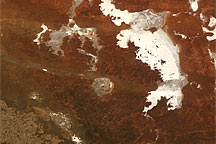
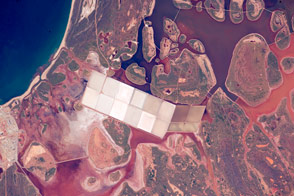
Acquired February 18, 2010, this true-color image shows Lake Acraman and surrounding saltpans in South Australia. The sprawling saltpans appear off-white, and the largely bare soils appear in shades of orange and brown.
Published Feb 28, 2010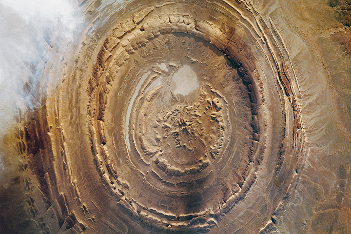
This geologic feature has captured the attention of astronauts for about as long as NASA has sent humans into orbit around Earth.
Published Apr 29, 2018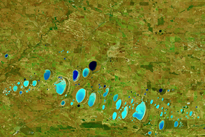
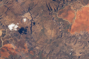
Many of the salt lakes in Western Australia are found along the valleys of ancient river systems that no longer flow.
Published Mar 26, 2016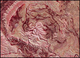
Spider Crater rests in a depression some 13 by 11 kilometers (8 by 7 miles) across. Meteorite craters often have central areas of uplift, and Spider Crater fits this pattern. Spider Crater sits in a depression and has a central uplift area characteristic of impact craters, it shows extreme differences in erosion, giving it a unique appearance.
Published Mar 30, 2008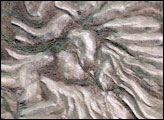
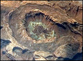
Upheaval Dome is a striking geologic structure in the Canyonlands National Park of southern Utah. The alternating rock layers make a nearly circular, 5.5-kilometer- (3.4-mile-) diameter “bull’s-eye.” This photograph of Upheaval Dome was taken by an astronaut onboard the International Space Station. The oblique viewing angle—in other words, not looking straight down—provides a sense of the topography within and around the structure. The dome appears more like an ellipse than a circle due to the oblique viewing perspective.
Published Jul 23, 2007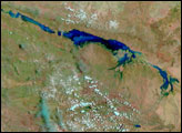
This stretch of Australian coast is noted for its tropical climate and its remoteness.
Published Jul 20, 2015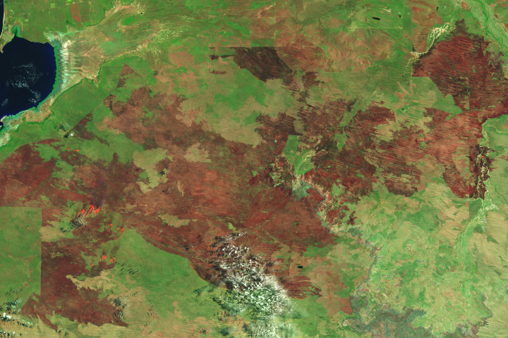
This dry season, a bushfire in western Australia wiped out an area six times the size of Los Angeles.
Published Nov 6, 2018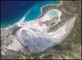
While the Great Lakes region of North America is well known for its importance to shipping between the United States, Canada, and the Atlantic Ocean, it is also the location of an impressive structure in the continent’s bedrock: the Michigan Basin. Formed during the Paleozoic Era (approximately 540–250 million years ago) the Basin looks much like a large bullseye defined by the arrangement of exposed rock layers that all tilt inwards, forming a huge bowl-shaped structure. The outer layers of the Basin include thick deposits of carbonates—rocks containing carbon and oxygen, such as limestone—deposited over millions of years when a shallow sea covered the region. These carbonate rocks are mined throughout the Great Lakes region using large open-pit mines. The largest carbonate mine in the world, Calcite Quarry, appears in this astronaut photograph.
Published Aug 7, 2006
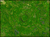
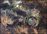
Roughly 220 million years ago, geologists estimate, a meteorite struck Earth here. Despite its age, Serra da Cangalha remains Brazil’s best-preserved impact crater, resting upon largely undisturbed sediments laid down some 300 million years ago.
Published Mar 16, 2008