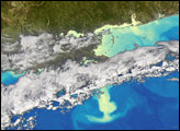
Acquired May 17, 2011, and May 22, 2011, these natural-color images show sediment in the Gulf of Mexico, one consequence of Mississippi River flooding.
Published Jun 23, 2011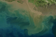
Sediment-laden water pours into the northern Gulf of Mexico from the Atchafalaya River in this photo-like image taken on April 7, 2009.
Published Apr 18, 2009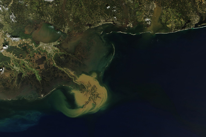
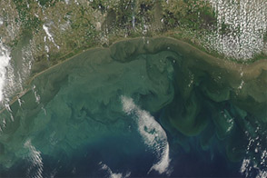
A pulse of flood water from the central United States spilled into the Gulf of Mexico.
Published Mar 9, 2018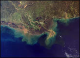
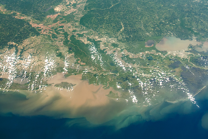
The river drains water and sediment from 31 U.S. states, delivering both to the Gulf of Mexico via the Atchafalaya and Mississippi River deltas.
Published Jul 5, 2019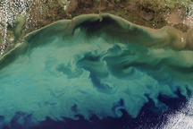
Tan and green clouds of sediment clouded the Gulf of Mexico on November 10, 2009.
Published Nov 13, 2009
In the summer months, a large portion of the Mississippi River outflow heads southeast into the Gulf of Mexico.
Published Sep 22, 2005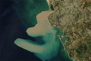
Acquired November 12 and 13, 2012, these images show a sediment plume along Spain’s southwestern coast.
Published Nov 18, 2012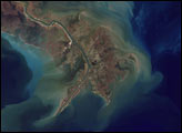
Taken May 17, 2011, this astronaut photograph shows a plume of thick sediment in Lake Pontchartrain, delivered through the Bonnet Carré Spillway.
Published May 20, 2011
The potent storm has discolored the Gulf of Mexico near Florida and Alabama.
Published Oct 15, 2018