This pair of images shows the vast extent of the Wallow Fire, burning in eastern Arizona, on June 6, 2011.
Published Jun 6, 2011
A wildfire in Fresno County, California has burned more than 28,000 acres.
Published Jul 20, 2020
The blaze is the largest in Arizona this year and the largest in the United States right now.
Published Jun 16, 2020Image of the Day Heat Land Fires Human Presence Remote Sensing
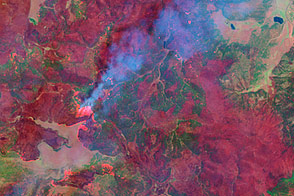
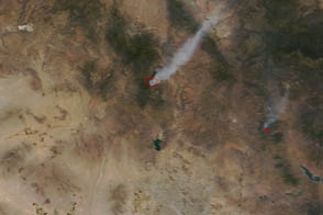
Peer through the billowing plume of smoke to see the hot spots associated with the Cedar fire in eastern Arizona.
Published Jun 23, 2016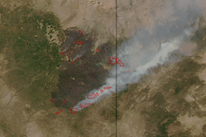
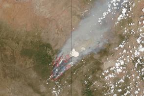
Only 10 percent contained, Arizona’s Wallow Fire became the largest fire in the state history on June 13 when this image was taken.
Published Jun 14, 2011
This false-color image illustrates the extent of the Station Fire in southern California.
Published Sep 15, 2009
This image from June 9, 2011, shows Arizona’s Wallow Fire in the White Mountains near the border with New Mexico.
Published Jun 10, 2011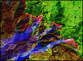
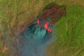
This false-color image taken by the Landsat-7 satellite on June 7, shows how completely the Wallow Fire is burning the forest in the mountains of eastern Arizona.
Published Jun 9, 2011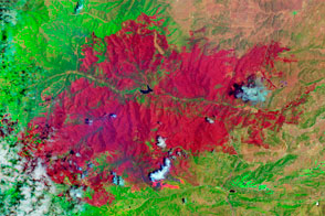
The EO-1 satellite observed the burn scar from the Little Bear Fire.
Published Jun 14, 2012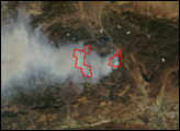
A wildfire north of Phoenix threatened the historic mining community of Crown King.
Published May 17, 2012