The green-brown waters of Lake Barkol sit within the pale shorelines of an ancient lake, hinting that the climate was once much wetter in this part of western China.
Published Jun 21, 2014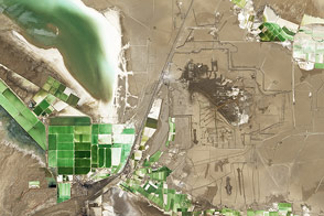
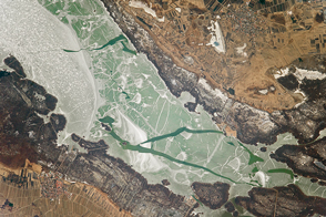
A rim of crystal salts surrounds Lake Qarhan, the largest salt lake playa in China and a significant source of minerals, including table salt and potassium for fertilizer.
Published Feb 2, 2014
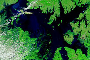
At the juncture of the border between China and Russia sits Lake Khanka, also known as Lake Xinghai. Due to their importance to plant and animal species, the lake and the surrounding wetlands are protected by the Ramsar Convention, an international treaty for the protection and sustainable use of wetlands. Migratory birds that frequent this lake include several endangered species, such as the Japanese crane.
Published Feb 18, 2007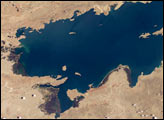
Lake Titicaca, at an elevation of 12,507 feet (3,812 meters) in the Andean Altiplano, is the highest large lake in the world. More than 120 miles long and 50 miles wide, it was the center of the Incan civilization, and today straddles the boundary between Peru and Bolivia.
Published Dec 22, 2003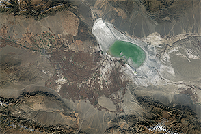
Declining water levels in this saline lake in northwestern China have exposed playa prone to producing dust storms.
Published Nov 25, 2014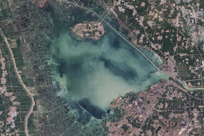
The fingerprints of human civilization are all over the lake in eastern China.
Published Jan 10, 2015
Great Salt Lake serves as a striking visual marker for astronauts orbiting over North America. A sharp line across its center is caused by the restriction in water flow from the railroad causeway. The eye-catching colors of the lake stem from the fact that Great Salt Lake is hypersaline, typically 3–5 times saltier than the ocean, and the high salinities support sets of plants and animals that affect the light-absorbing qualities of the water. Space Station astronauts have recorded the decline in lake levels in response to a regional 5-year drought taking both detailed views and broad views of the entire lake. As lake levels have declined the salt works have become islands in the middle of a dry lakebed.
Published Jan 19, 2004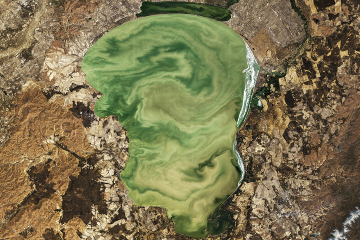
Located on the border of Russia and China, Lake Khanka plays an important role in supporting biodiversity in the region.
Published Jun 10, 2019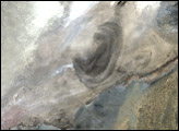
Acquired April 1 and May 21, 2012, these images show rising water in southeastern China’s Poyang Lake.
Published May 23, 2012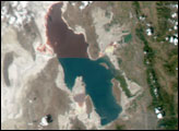
Straddling Austria and Hungary, the lake is also known as the “Sea of the Viennese.”
Published Apr 10, 2017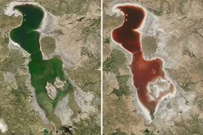
When the water gets saltier in Iran’s largest lake, the microscopic inhabitants can turn the water dark red.
Published Jul 26, 2016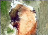
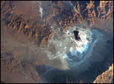
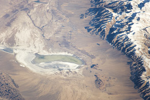
Searles Lake is known for the abundance of rare elements and evaporate minerals, such as trona, hanksite, and halite formed within its sediments. Evaporites are minerals that are left behind when saltwater evaporates. This astronaut photograph depicts the Searles Lake playa (characterized by white surface mineral deposits) bounded by the Argus and Slate Mountains. The width of the playa is approximately 10 kilometers. The center of the image is dominated by mining operations that extract sodium- and potassium-rich minerals (primarily borax and salt) for industrial use.
Published Jul 11, 2005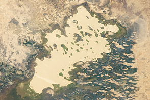
In the desert, a lake shows a long fight between water, wind, and climate.
Published Feb 20, 2012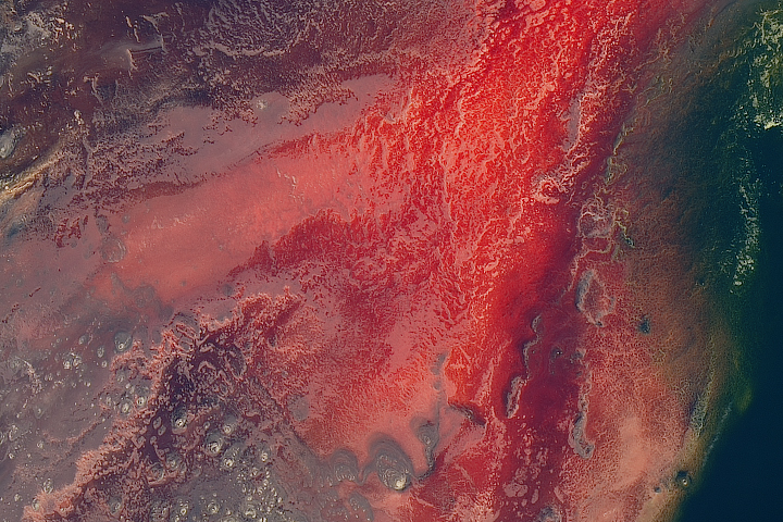
The lake is mostly inhospitable to life, except for a few species adapted to its warm, salty, and alkaline water.
Published May 8, 2017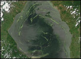
The Venezuelan government declared a state of emergency in mid-June to remove the fast-growing weed, spending about $2 million per month on clean-up efforts.
Published Jul 13, 2004