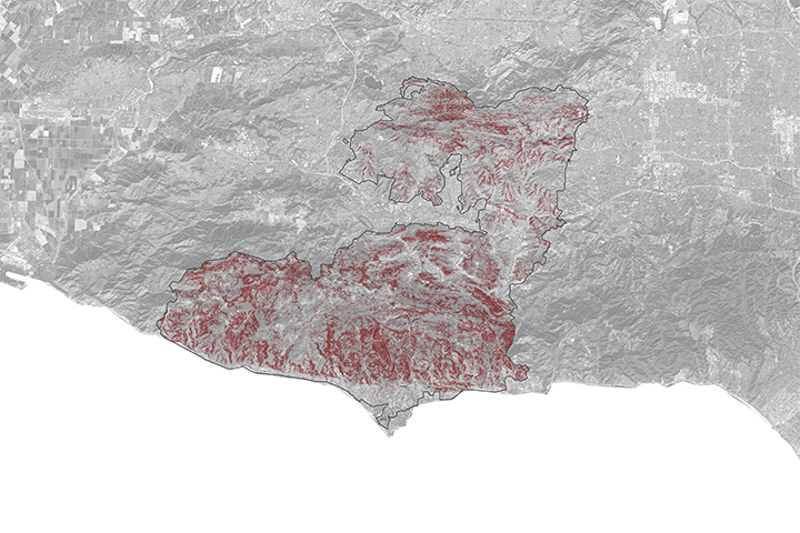
A NASA project is providing maps of satellite data to emergency response teams during the Woolsey Fire.
Published Nov 16, 2018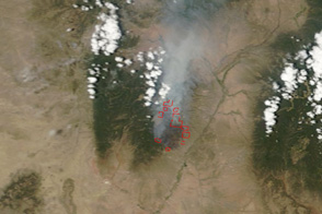
This pair of images shows the Las Conchas Fire burning near the western edge of Los Alamos National Laboratory on June 29, 2011.
Published Jun 30, 2011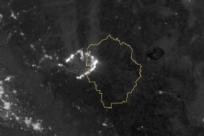
Burning in the northeast corner of Yosemite National Park, the Rim Fire ranks among the largest in California history.
Published Aug 28, 2013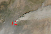
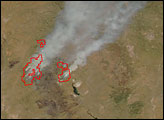
Dense smoke billows from the White Fire, a large forest fire burning in southern New Mexico, in this true-color image from April 3, 2011.
Published Apr 4, 2011
The fast-moving King fire burned in Eldorado National Forest in September 2014.
Published Sep 18, 2014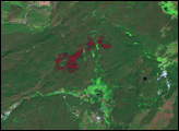

An expansive, destructive wildfire north of Los Angeles is visible from space by day and night.
Published Jun 28, 2016
A wildfire in Fresno County, California has burned more than 28,000 acres.
Published Jul 20, 2020
The blaze is the largest in Arizona this year and the largest in the United States right now.
Published Jun 16, 2020Image of the Day Heat Land Fires Human Presence Remote Sensing
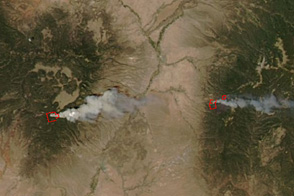
Taken an hour and a half after the Las Conchas Fire started in the mountains southwest of Los Alamos, New Mexico, on June 26, this image shows the large wildfire well underway.
Published Jun 27, 2011
This image from June 9, 2011, shows Arizona’s Wallow Fire in the White Mountains near the border with New Mexico.
Published Jun 10, 2011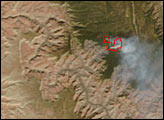
At 369 square miles in size, the Rim Fire is the largest in the United States in 2013.
Published Sep 4, 2013
A wildfire burning in Los Padres National Park charred more than 500 acres—including the home of Big Sur’s fire chief.
Published Dec 17, 2013