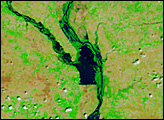
Acquired March 1 and 20, 2011, these false-color images show rising waters on the Mississippi River and some of its tributaries.
Published Mar 21, 2011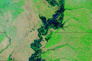
Acquired May 20, 2011, and April 14, 2011, these false-color images show water levels along the Mississippi River.
Published May 23, 2011
These false-color images compare conditions along the Mississippi and Yazoo Rivers around Vicksburg in June 2011, during heavy flooding, and three years earlier.
Published Jun 14, 2011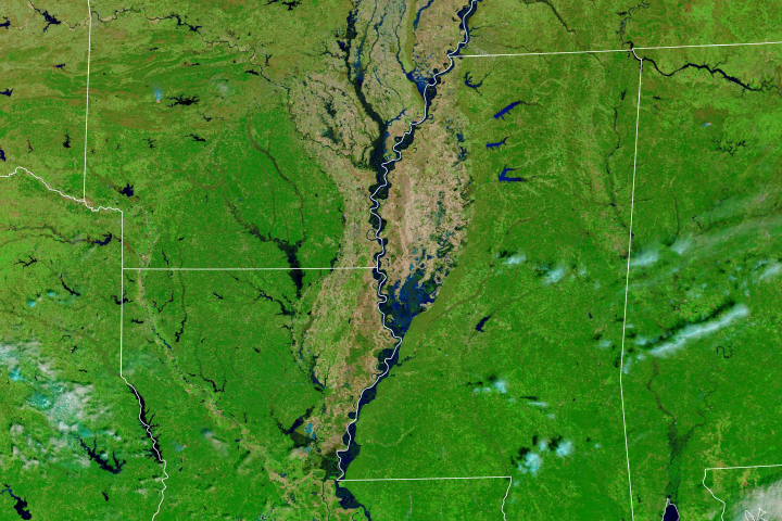
Much of the Lower Mississippi River was flooded in March.
Published Mar 20, 2019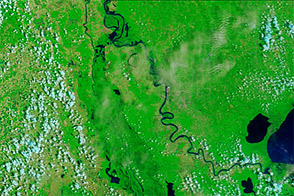
Acquired June 8, 2011, and June 9, 2010, these false-color images compare conditions along the Mississippi and Atchafalaya Rivers in Louisiana.
Published Jun 9, 2011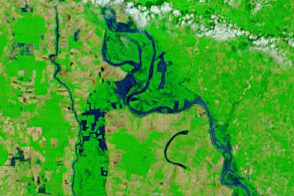
Acquired May 18, 2011, and May 4, 2011, these false-color images show flooded conditions along the Lower Mississippi River, including diverted water entering the Morganza Floodway on May 18.
Published May 18, 2011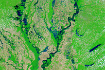
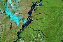
Acquired May 8, 2011, April 29, 2011, and May 3, 2010, these false-color images show water levels along the Mississippi River between Memphis and Vicksburg.
Published May 9, 2011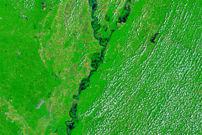
Acquired June 1, 2011, and May 28, 2010, these false-color images compare conditions along the Lower Mississippi River.
Published Jun 1, 2011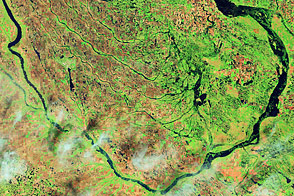
Acquired June 1, 2011, and July 2, 2002, these false-color images compare conditions along the Souris River in North Dakota.
Published Jun 6, 2011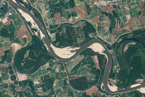
Coming off of the extreme floods of 2011, the river was approaching historic lows in the summer of 2012 near Memphis and along much of its lower reaches.
Published Aug 21, 2012