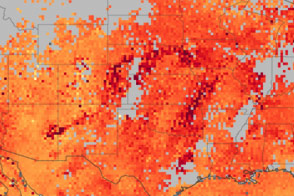
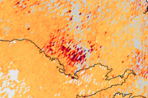
The high carbon monoxide concentrations shown in this satellite-based map reflect the poor air quality seen in the central and eastern United States on June 8, 2011.
Published Jun 10, 2011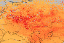
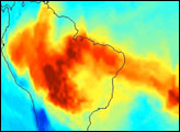
This image, made with data from the Terra satellite, shows high levels of carbon monoxide over western Russia during the first week of August 2010.
Published Aug 11, 2010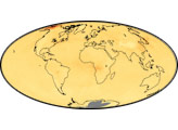
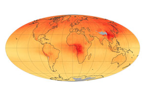
Concentrations of the gas, which is produced by burning carbon-based fuels, have decreased since 2000.
Published Jun 2, 2015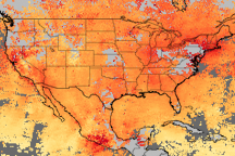
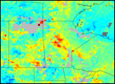
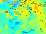
Elevated concentrations of carbon monoxide trace the transport of smoke from agricultural fires across Mexico, southern Canada, and the U.S. Great Plains and New England.
Published May 29, 2010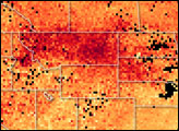
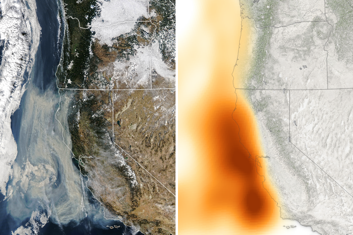
Smoke and carbon monoxide are among the mixture of emissions lofted into the air and carried offshore.
Published Dec 12, 2017Image of the Day Atmosphere Land Fires Human Presence Remote Sensing
The highest concentrations of carbon monoxide, a component of smoke, are centered over large fire complexes in Russia in this image that tracks smoke transport across the Arctic.
Published Aug 1, 2009