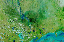
Acquired on March 9, 2011, and March 10, 2010, these false-color images show flooding along the Angola-Namibia border in 2011.
Published Mar 10, 2011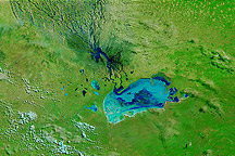
Acquired April 12, 2011, and April 22, 2010, these false-color images show differences in rainy season conditions in northern Namibia.
Published Apr 12, 2011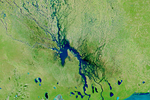
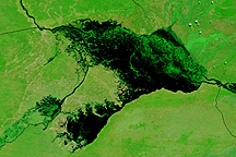
Channels of water flowed through normally dry northern Namibia on March 23, 2009, when this image was captured.
Published Mar 23, 2009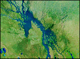

This pair of images from the Advanced Spaceborne Thermal Emission and Reflection Radiometer (ASTER) on NASA’ Terra satellite shows wide-spread flooding in Oshakati, Namibia, on March 28, 2009.
Published Apr 1, 2009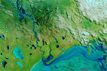
Acquired March 20, 2011, and March 17, 2010, these false-color images show evidence of unusually heavy precipitation in 2011.
Published Mar 24, 2011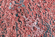
The northern Namibian city of Ondangwa seems to be built on a sponge in these images, which show flooding around the city on March 28, 2009.
Published Apr 1, 2009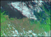
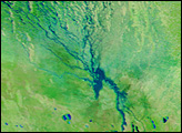
Water stretches across kilometers of land in Namibia's Caprivi strip in this Terra MODIS image from April 14, 2009.
Published Apr 16, 2009