Acquired June 5, 2011, and May 19, 2005, these false-color images compare conditions along the James River near Mitchell, South Dakota.
Published Jun 7, 2011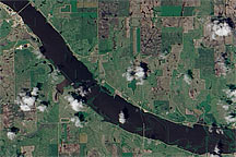
Acquired June 24, 2010, this natural-color image shows the swollen James River covering normally dry land in the river valley.
Published Jun 28, 2010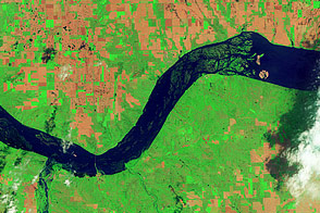
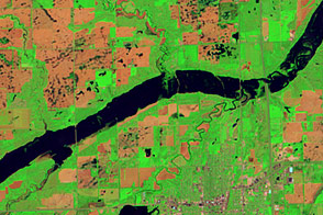
Acquired June 5, 2011, and May 19, 2005, these false-color images compare conditions around Lewis and Clark Lake in South Dakota.
Published Jun 7, 2011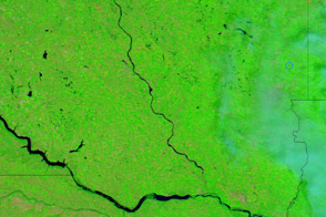
Acquired August 1, 2011, and August 6, 2010, these false-color images compare conditions along the James River, a Missouri River tributary, in South Dakota.
Published Aug 2, 2011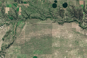
Cliffs, waterfalls, and a wide mix of vegetation line a river that winds through the Great Plains in Nebraska.
Published May 29, 2016
Floods and new infrastructure have long since separated the distinctive bend in the river that was portrayed by landscape painter Thomas Cole in 1836.
Published Oct 15, 2017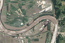
Acquired June 19, 2010, this natural-color image shows flooding along the banks of the Missouri River near the town of Glasgow.
Published Jun 22, 2010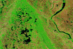
Acquired June 1, 2011, and May 29, 2010, these false-color images compare parts of the James and Little Minnesota Rivers.
Published Jun 2, 2011
This photo-like image shows extensive flooding on the Red River near Fargo, North Dakota, on March 28, 2009 as the river reached a record high of 40.82 feet.
Published Mar 30, 2009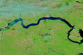
Acquired June 1, 2011, and June 4, 2010, these false-color images compare parts of the Missouri and Souris Rivers.
Published Jun 2, 2011
Trees have long been cherished here for timber and for the colors they bring to “the Fall Rhapsody.”
Published Oct 24, 2020
Acquired April 2, 2011, and February 27, 2011, these natural-color images show rising waters on the Kuiseb River, which flowed all the way to the Atlantic Ocean for the first time in decades.
Published Apr 12, 2011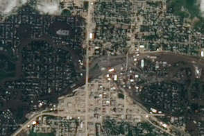
Acquired June 25, 2011, this image shows widespread flooding in the city of Minot, North Dakota, as the Souris River was reaching a historic crest.
Published Jun 30, 2011