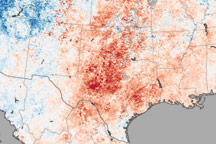
This temperature map shows the extremely warm temperatures that helped create hazardous fire conditions in Texas in April.
Published Apr 22, 2011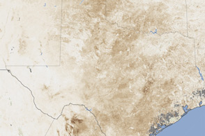
Severe drought has taken a serious toll on vegetation and farmers in Texas, New Mexico, and Oklahoma.
Published Jul 27, 2011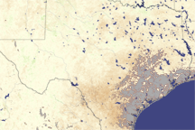
Most of Texas is brown in this vegetation index image, revealing the negative impact drought had on plants in August 2009.
Published Aug 12, 2009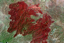
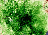
This Landsat image, taken on May 2, 2011, shows all 314,444 acres burned in the Rockhouse Fire in southwestern Texas.
Published May 5, 2011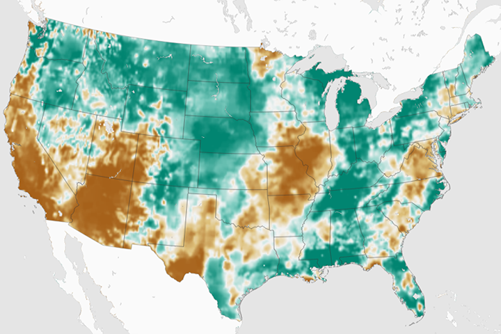
By late February 2018, an estimated 55 percent of the continental U.S. was classified as abnormally dry.
Published Mar 2, 2018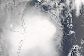
Tropical Storm Don was approaching southwestern Texas when this true-color image was taken on July 30, 2011.
Published Jul 31, 2011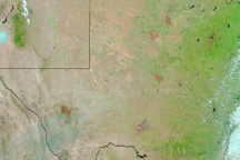
Burn scars dot the state of Texas in this image from April 30, 2011.
Published Apr 27, 2011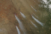
Several large wildfires send plumes of smoke streaming across Texas in this natural-color image taken on April 15, 2011.
Published Apr 19, 2011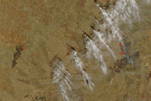
Taken on April 10, 2011, this true-color image shows two large wildfires burning in central Texas near Lubbock.
Published Apr 11, 2011