Most of Texas is brown in this vegetation index image, revealing the negative impact drought had on plants in August 2009.
Published Aug 12, 2009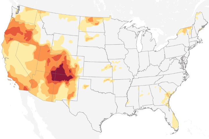
Drought conditions in 2018 are extreme over the Four Corners region of the United States.
Published Nov 8, 2018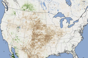
In August 2012, satellites observed the effects of drought and heat waves on vegetation from the Rocky Mountains to the Mississippi River.
Published Oct 3, 2012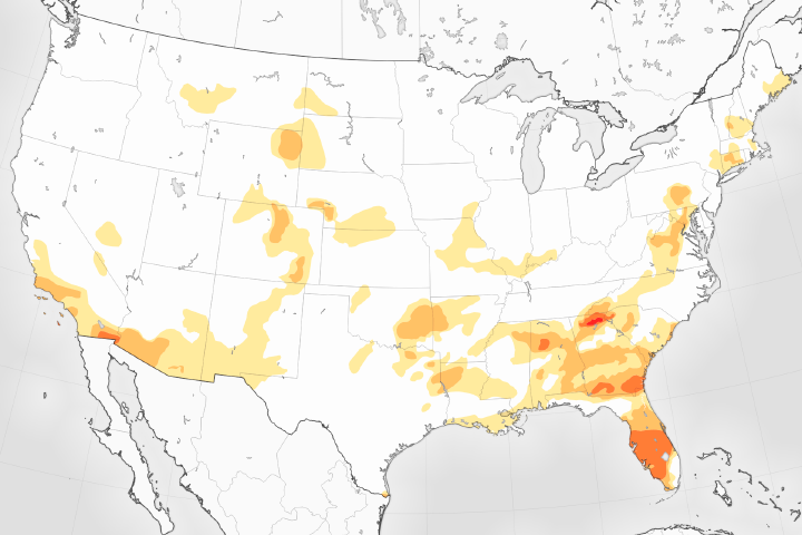
The U.S. Drought Monitor reports its lowest levels in 17 years.
Published May 5, 2017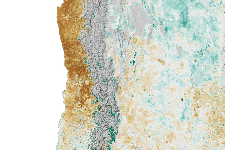
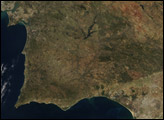
Vegetation is withering across Central Chile.
Published Nov 18, 2019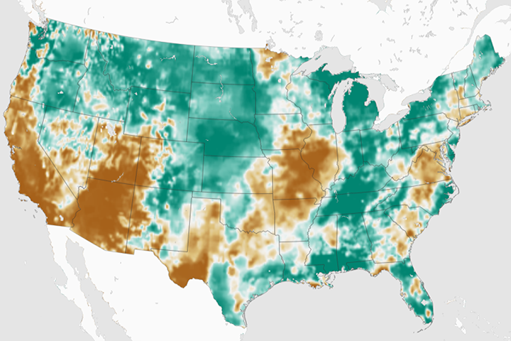
By late February 2018, an estimated 55 percent of the continental U.S. was classified as abnormally dry.
Published Mar 2, 2018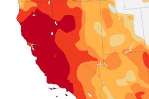
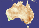
More than 64 million people are directly affected by drought in the Southwest and Southern Plains, and far more are indirectly affected because of the vast number of farms, orchards, and ranches that supply the rest of the United States.
Published Nov 27, 2014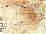
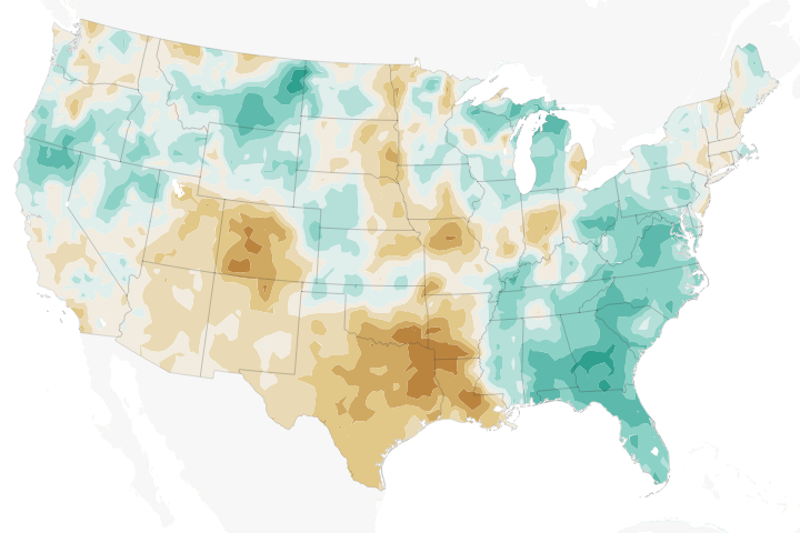
Temperatures across much of the region in 2018 have been well above the norms, while precipitation has been well below—a recipe for struggling farmers and concerned forest fire managers.
Published Jun 12, 2018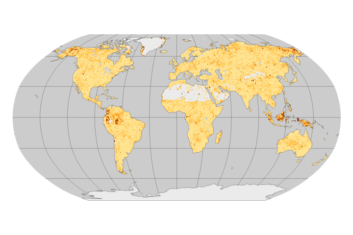
If the time between droughts grows shorter and the time to recover from them keeps growing longer, some ecosystems could reach a tipping point and change permanently.
Published Sep 13, 2017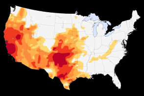
Severe to extreme drought persists in the Southwest and the Plains in May 2014.
Published May 13, 2014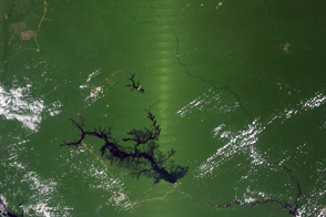
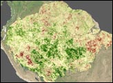
A new analysis shows how changes in the angle between the Sun and a satellite sensor interact to create the illusion of Amazon forest greening during the dry season.
Published Feb 7, 2014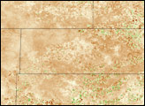
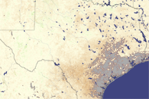
As of early August 2008, the Oklahoma panhandle was experiencing its driest year (previous 365 days) since 1921, according to records kept by the Oklahoma Climatological Survey. Through July, year-to-date precipitation in Boise City, in the heart of Cimarron County, was only about 4.8 inches, barely half of average and drier than some years in the 1930s, the height of the Dust Bowl.
Published Aug 14, 2008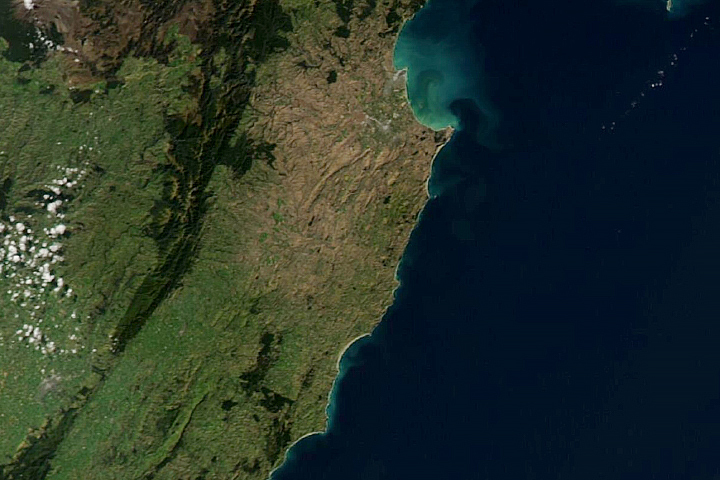
North Island vegetation shows signs of stress during one the region’s most severe droughts on record.
Published May 7, 2020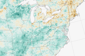
A dry summer is giving farmers in the Northeast one of their toughest seasons in years.
Published Sep 13, 2016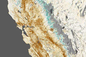
Nearly all of California was in a state of extreme drought at the end of January 2014. Forests and farms clearly showed the effects in satellite measurements of vegetation.
Published Feb 14, 2014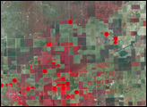
In the second week of August 2008, the western Oklahoma Panhandle got just enough rain to ease the region’s drought status from “exceptional” to “extreme“ according to the U.S. Drought Monitor report from August 12. The scattered August rains may be responsible for some of the vegetation patterns recorded by the Advanced Spaceborne Thermal Emission and Reflection Radiometer (ASTER) on NASA’s Terra satellite in this image from August 14, 2008.
Published Aug 20, 2008