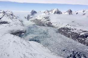
NASA aircraft return to the Arctic to assess the health of the region’s ice.
Published May 3, 2012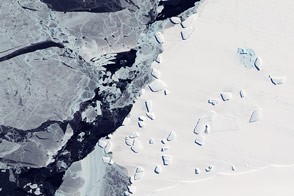
Acquired October 7, 2011, this natural-color image shows an ice menagerie off the coast of East Antarctica.
Published Oct 23, 2011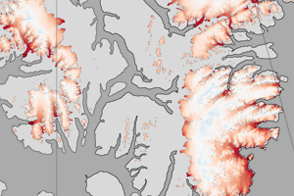
These color-coded maps show ice mass changes in the northern Canadian Arctic Archipelago from 2004 to 2009.
Published Jun 1, 2011
New elevation measurements will give researchers an unprecedented understanding of the thickness of sea ice, which will be used to help improve climate modeling and forecasts.
Published Dec 18, 2018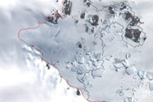
This image shows the latest estimate of the ice edge around Law Promontory, which juts out from East Antarctica’s coastline near Stefansson Bay.
Published Jul 23, 2010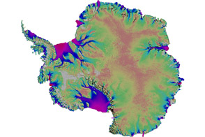
Scientists mapped the motion of Antarctica’s ice sheets and revealed unexpected patterns.
Published Aug 19, 2011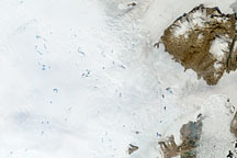
To understand ice sheets, glaciologists venture both below the surface with ice cores, and into the sky with satellites. Satellite imagery of the Greenland Ice Sheet reveals melt ponds that can affect glacier flow and sea level.
Published Oct 29, 2008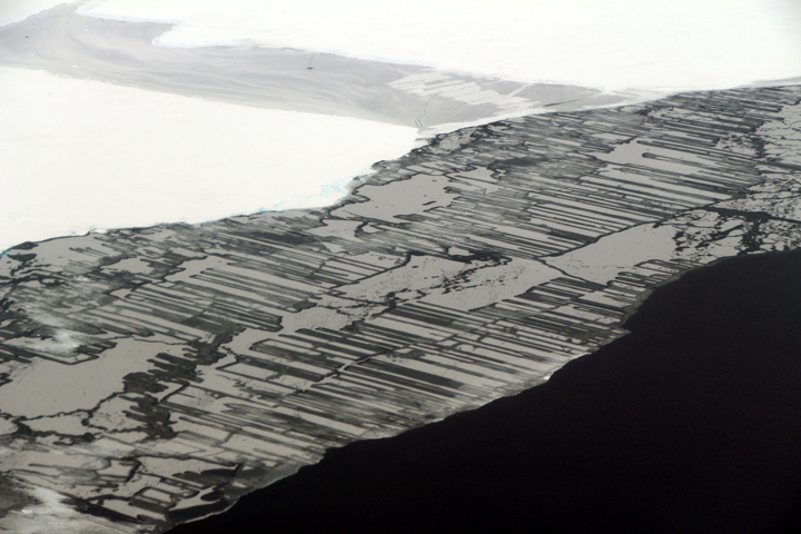
As a result of the collision, blocks of ice slide above and below each other in a pattern that resembles a zipper or interlocking fingers.
Published Nov 22, 2017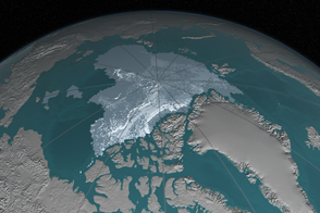
In 1984, there were 1.86 million square kilometers of old ice spread across the Arctic at its yearly minimum extent. In September 2016, there were only 110,000 square kilometers of old ice left.
Published Nov 4, 2016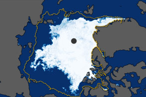
In September 2011, the extent of sea ice covering the Arctic Ocean declined to the second-lowest extent on record.
Published Oct 5, 2011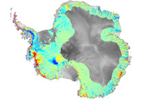
To understand how fast-moving glaciers are changing the ice sheets, scientists devised a method to map elevation change using data from ICESat.
Published Oct 3, 2009
To the untrained eye, Antarctica may look like a giant piece of solid ice that rarely changes, but scientists studying the continent have long known better. The icy surface is dynamic, with glaciers and "streams" of ice flowing toward the ocean.
Published Apr 27, 2007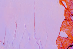
The impending birth of a big, new iceberg from Antarctica’s Larsen C Ice Shelf will not have an immediate effect on sea level, but it could be an indicator of future problems.
Published Apr 14, 2017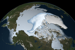
Thick ice that used to last through multiple summers has been in steep decline for three decades.
Published Mar 1, 2012