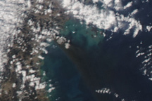
Acquired in March 2011 and February 2012, these images document the recession of flood waters after the Tohoku tsunami.
Published Mar 13, 2012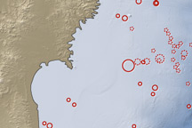
On March 11, 2011, a magnitude 8.9 earthquake struck off the east coast of Honshu, Japan, about 130 kilometers (80 miles) east of Sendai. If the initial estimate is confirmed, it will be the fifth largest earthquake in recorded history.
Published Mar 12, 2011
This map shows the location of a large aftershock off the coast of Japan on April 7, 2011.
Published Apr 7, 2011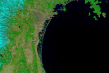
Skies over northeastern Japan were entirely cloud-free on March 13, 2011, providing a clear view of tsunami flooding along the coastline.
Published Mar 13, 2011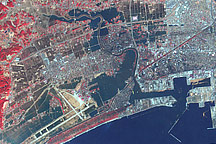
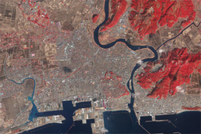
This false-color image acquired on March 14, 2011, shows widespread flooding in tsunami-hit Ishinomaki, Japan.
Published Mar 15, 2011
Sobering satellite views reveal massive damage on the Indonesian island of Sulawesi.
Published Oct 3, 2018Image of the Day Land Water Human Presence Remote Sensing Earthquakes
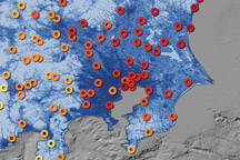
This map shows the ground motion and shaking intensity from the March 11, 2011, earthquake at dozens of locations across Japan.
Published Mar 19, 2011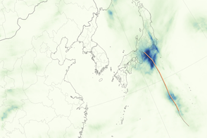
Though it never reached typhoon status, Etau provoked record-setting rain in several prefectures.
Published Sep 11, 2015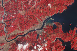
One year after the tsunami, the landscape near the mouth of the Kitakami river remains irrevocably altered.
Published Mar 11, 2012
Planted in Japan for at least the last four centuries, greenbelts protect coastlines from storms and sand movement; they are increasingly providing recreation areas as well.
Published May 19, 2014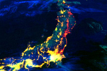
This color-coded composite image shows lights working or not after the earthquake and tsunami in Japan. The image compares observations from March 12, 2011, to data collected in 2010.
Published Mar 19, 2011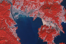
Acquired March 14, 2011, and March 1, 2007, these false-color images show the city of Rikuzentakata before and after a tsunami reshaped the local coastline.
Published Mar 18, 2011Image of the Day Land Water Floods Human Presence Earthquakes
A heavy black plume of smoke streams southeast from Sendai, Japan, in this photo-like image from March 12, 2011. The smoke likely originated from a fire burning in an oil refinery in the wake of the massive earthquake that struck the city on March 11.
Published Mar 12, 2011