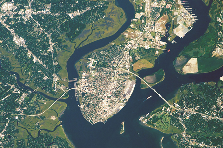
Surrounded by meandering rivers and a marshy landscape, this South Carolina city has been a focal point for American history and for shipping.
Published Jun 10, 2018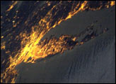
Bright city lights along the coastline and interior delineate the eastern coast of the United States at night.
Published Apr 13, 2003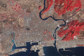
Acquired in March 2011 and February 2012, these images document the recession of flood waters after the Tohoku tsunami.
Published Mar 13, 2012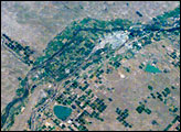
Lake McConaughy and a tan-and-green patchwork of thousands of agricultural fields dominate this astronaut photo of western Nebraska and northeastern Colorado. The astronaut who shot this view was looking towards the east-northeast, focusing on the thin, green lines of the floodplains of the North and South Platte rivers. These join to form the Platte River near image upper right.
Published Oct 8, 2007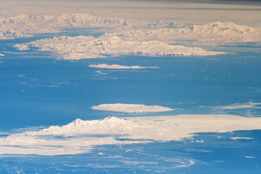
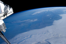
Astronauts on the ISS captured an unusual, airplane-like view of the Antarctic Peninsula and nearby islands.
Published Dec 5, 2011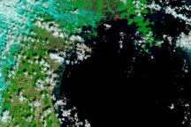
The Japanese coastline near Sendai is flooded in this false-color image, taken March 12, 2011, nearly a day after a earthquake-generated tsunami inundated the coast.
Published Mar 13, 2011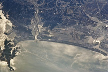
Taken March 13, 2011, this astronaut photograph shows the Japanese coast north of the city of Sendai, in the wake of a devastating earthquake and tsunami.
Published Mar 15, 2011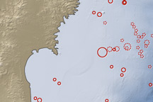
On March 11, 2011, a magnitude 8.9 earthquake struck off the east coast of Honshu, Japan, about 130 kilometers (80 miles) east of Sendai. If the initial estimate is confirmed, it will be the fifth largest earthquake in recorded history.
Published Mar 12, 2011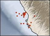
This sequence of time-lapse photographs illustrates roughly half an orbit of the International Space Station, from Northern Europe to Australia.
Published Jun 28, 2010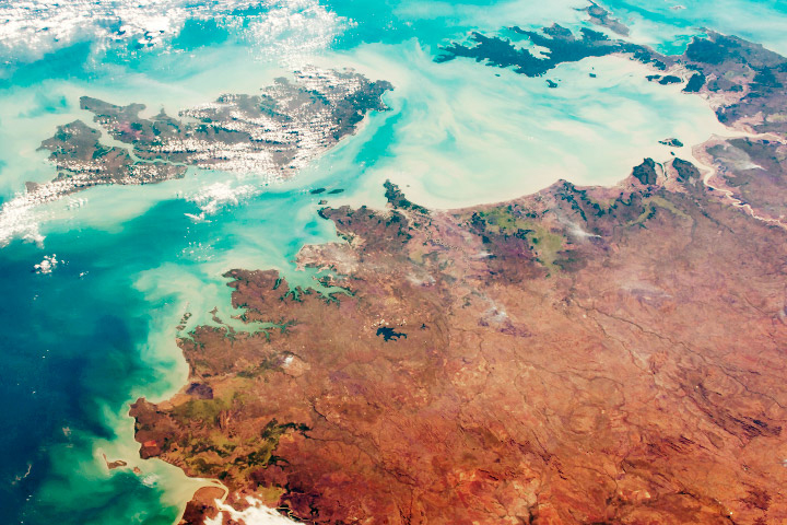
This northern part of Australia is sparsely populated but rich in national park and conservation land.
Published Aug 5, 2018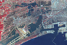
This false-color image acquired on March 14, 2011, shows widespread flooding in tsunami-hit Ishinomaki, Japan.
Published Mar 15, 2011