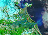
The Japanese coastline near Sendai is flooded in this false-color image, taken March 12, 2011, nearly a day after a earthquake-generated tsunami inundated the coast.
Published Mar 13, 2011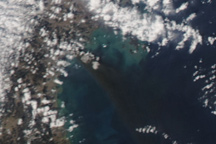
A heavy black plume of smoke streams southeast from Sendai, Japan, in this photo-like image from March 12, 2011. The smoke likely originated from a fire burning in an oil refinery in the wake of the massive earthquake that struck the city on March 11.
Published Mar 12, 2011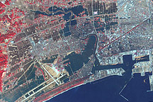
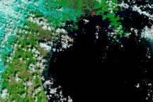
This false-color image acquired on March 14, 2011, shows widespread flooding in tsunami-hit Ishinomaki, Japan.
Published Mar 15, 2011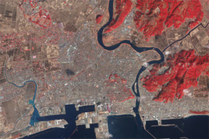
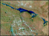
Acquired in March 2011 and February 2012, these images document the recession of flood waters after the Tohoku tsunami.
Published Mar 13, 2012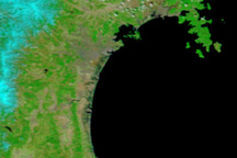
Taken on April 1, 2011, this image shows that floods linger in Japan’s tsunami-hit areas a full three weeks after the disaster occurred.
Published Apr 1, 2011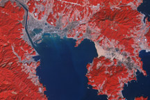
Acquired March 14, 2011, and March 1, 2007, these false-color images show the city of Rikuzentakata before and after a tsunami reshaped the local coastline.
Published Mar 18, 2011Image of the Day Land Water Floods Human Presence Earthquakes
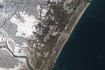
Acquired March 18, 2011, this natural-color image shows agricultural fields near Sendai, Japan, covered with either snow or flood water.
Published Mar 20, 2011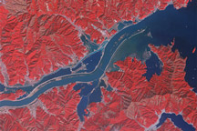
Acquired March 15, 2011, and January 16, 2011, these false-color images show part of the Kitaami River before and after the 8,9-magnitude earthquake and tsunami struck Japan in early March 2011.
Published Mar 16, 2011