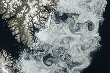
Sea ice formed delicate swirls along the coast of Baffin Island in this true-color image acquired July 11, 2009.
Published Jul 24, 2009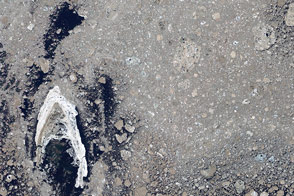
Sea ice from the Foxe Basin tends to be rougher and more stained than other parts of the Arctic.
Published May 24, 2014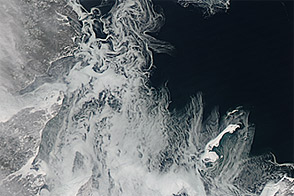
As Arctic sea ice grew toward its maximum extent, it began to fill the Gulf of St. Lawrence in February 2013.
Published Feb 20, 2013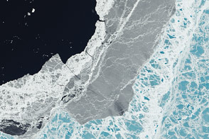
A mixture of ice types exists where frozen water meets open water.
Published Mar 11, 2015
Carried by winds and currents, sea ice can reach the coast of Hokkaido, Japan.
Published Mar 19, 2020
New elevation measurements will give researchers an unprecedented understanding of the thickness of sea ice, which will be used to help improve climate modeling and forecasts.
Published Dec 18, 2018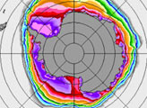
Off the tip of Urup Island, the difference between sea ice and island can be hard to identify.
Published Apr 19, 2010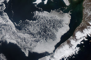
Acquired April 11 and 24, 2012, these images show the movement of sea ice in the Bering Sea with the advance of spring.
Published May 6, 2012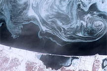
Sea ice formed delicate swirls of blue and white in the Sea of Okhotsk in February 2009.
Published Feb 27, 2009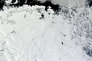
Winds pushed Antarctic sea ice north of its typical location in February 2013.
Published Mar 1, 2013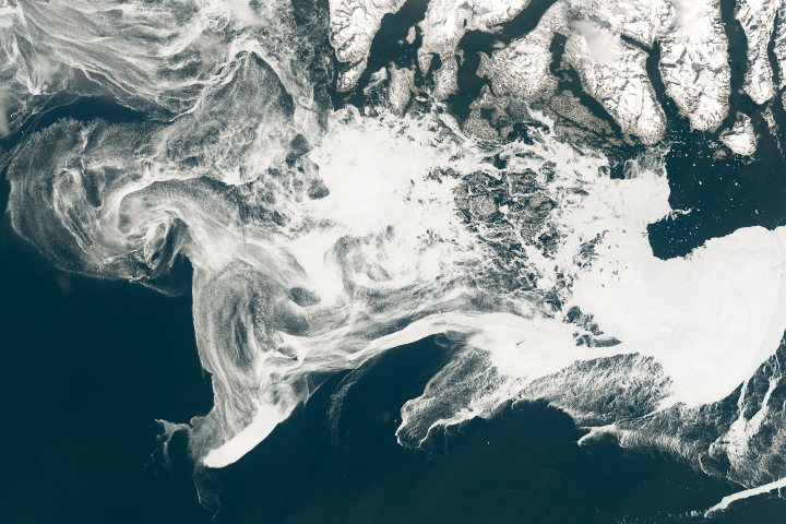
Filaments of sea ice stretch across the waters off southern Greenland, an area that is typically ice-free.
Published May 18, 2019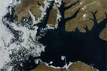
Acquired August 17, 2010, this natural-color image shows a mostly clear McClure Strait, except for some sea ice west of Prince Patrick Island.
Published Aug 18, 2010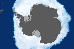
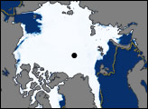
As the Arctic experienced a new record summer minimum for ice extent, the Antarctic set a new record for maximum winter sea ice.
Published Oct 11, 2012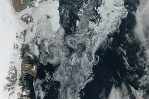
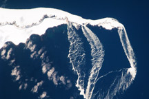
Sea ice and glacial ice mixes off the northeast coast of the great island.
Published Aug 24, 2014