Acquired January 19, 2011, and January 20, 2010, these false-color images show parts of New South Wales and Victoria before and after flooding struck the region in 2011.
Published Jan 19, 2011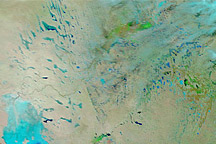
Acquired January 14, 2011, and December 29, 2010, these false-color images show changes to Australia’s interior caused by heavy rains.
Published Jan 14, 2011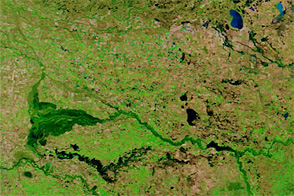
Acquired in late February and mid-March 2012, this image pair shows rising flood waters in southeastern Australia.
Published Mar 16, 2012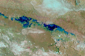
Heavy rains filled a dry valley in northwestern Australia between January 6 and 15, 2012.
Published Jan 17, 2012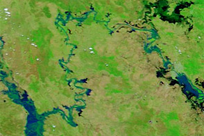
Acquired January 17 and 30, 2013, these images compare conditions along the Mackenzie-Fitzroy River system.
Published Jan 31, 2013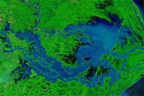
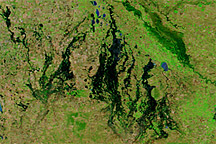
Acquired September 27, 2011, and September 28, 2010, these false-color images compare conditions along the Brahmani and Mahanadi Rivers in India. Severe flooding struck the region in 2011.
Published Sep 28, 2011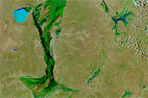
Floods continued to spread across the interior of Australia in late January 2011, with high waters apparent in Queensland, New South Wales, and South Australia.
Published Jan 20, 2011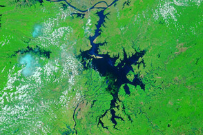
Acquired June 27, 2011, and May 28, 2011, these false-color images compare conditions along the Yangtze River before and after torrential rains.
Published Jun 28, 2011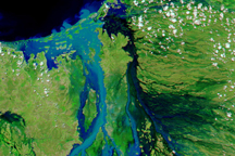
The Flinders River in northern Queensland, Australia, spread over more than 100 kilometers on February 18, 2009, when this image was taken.
Published Feb 21, 2009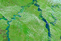
Acquired on December 31, 2010, and December 28, 2009, these images show part of Queensland, Australia, before and after flooding affected the state in late December 2010.
Published Dec 31, 2010