
This natural-color image shows Henrietta Island, with a smooth, dome-capped surface and a rugged coastline, illuminated by low-angled sunlight.
Published May 3, 2009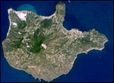
The Aeolian Islands formed from a chain of volcanoes in the Tyrrhenian Sea north of the island of Sicily. Geologists and volcanologists have studied the islands since the eighteenth century, and the United Nations Educational, Scientific, and Cultural Organization (UNESCO) declared them a World Heritage Site in 2000 because of their value to the study of volcanic processes.
Published Sep 1, 2008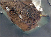
Kharg Island is Iran’s primary oil export terminal in the Persian Gulf. This rocky limestone island is unique because it is one of the few islands in the Persian Gulf with freshwater which has collected within the porous limestone. In addition to its commercial and strategic importance, the freshwater has biological importance, supporting populations of gazelles. This high-resolution photograph taken by astronauts on board the International Space Station shows detail of the tanker dock facilities, tanks and other infrastructure. Sunglint on the surface of the water highlights small amounts of oil on the sea surface and reveals the direction of the local currents.
Published Jan 12, 2003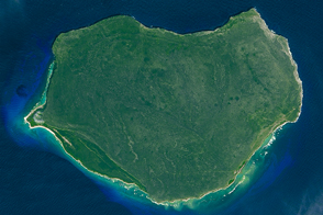
The small Puerto Rican island is a natural reserve that has been nicknamed the “Galapagos of the Caribbean.”
Published Feb 28, 2016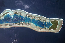
This astronaut photo of Millennium Island shows emerald islets surrounding a turquoise lagoon dotted with coral.
Published Jul 13, 2009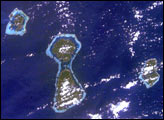
In one frame International Space Station astronauts were able to capture the evolution of fringing reefs to atolls. As with the Hawaiian Islands, these volcanic hot spot islands become progressively older to the northwest. As these islands move away from their magma sources they erode and subside.
Published Feb 16, 2003
A small Greek island with a long history rises from the Mediterranean and Aegean seas.
Published Jul 31, 2015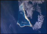
he Republic of Kiribati is an island nation consisting of some 33 atolls near the equator in the central Pacific. Before Europeans found the islands, they had been inhabited for two millennia by indigenous Micronesians. In 1820, the British named the islands the Gilbert Islands, after Captain Thomas Gilbert, who discovered some of the atolls in 1788. The islands eventually gained their independence in the 1970s.
Published Dec 29, 2005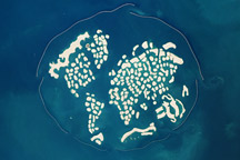
Taken January 13, 2010, this astronaut photograph shows two artificial archipelagos along the Dubai coast: Palm Jumeirah and The World. The image also shows the 800-meter-tall Bhurj Khalifa high rise building.
Published Feb 1, 2010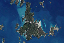
The Whitsunday Islands are a collection of some 74 islands sandwiched between the Australian mainland and the outer atolls of the Great Barrier Reef.
Published Jan 2, 2010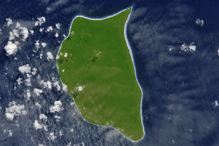
For hundreds of years, Henderson Island has seen little human activity. Nonetheless, it has human fingerprints all over its beaches.
Published Jul 23, 2017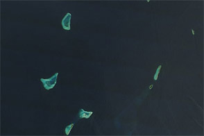
Lakshadweep’s coral atolls glow iridescent blue-green in this natural-color scene from February 2012.
Published Apr 15, 2012
A series of storms has redistributed the sand and the so-called "Shelly Island" is no longer an island.
Published Mar 8, 2018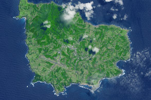
A 35-square-kilometer island rises from the Pacific Ocean about 1,400 kilometers from the Australian mainland.
Published May 23, 2015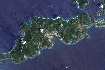
Acquired September 17, 2005, this true-color image shows Tortola, the largest of the British Virgin Islands. Also shown are Tortola’s smaller neighbors: Guana Island, Grand Camanoe, and Beef Island.
Published Nov 29, 2009