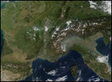
The Bernese Alps form the centerpiece of this late summer view of Switzerland; Jungfrau (4158 m), Moench (4089 m), and Eiger (3970 m) are among the higher peaks of the Central Alps. North of the range is the city of Interlaken, flanked by the Thune See and Brienzer See (lakes); the long, straight-segmented valley of the Rhone lies to the south.
Published Oct 21, 2001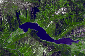
The beauty of the landscape of the eastern Alps, combined with the region's history, led the United Nations Educational, Scientific and Cultural Organization (UNESCO) to recognize it as a World Heritage Site.
Published Dec 25, 2011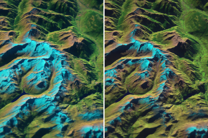
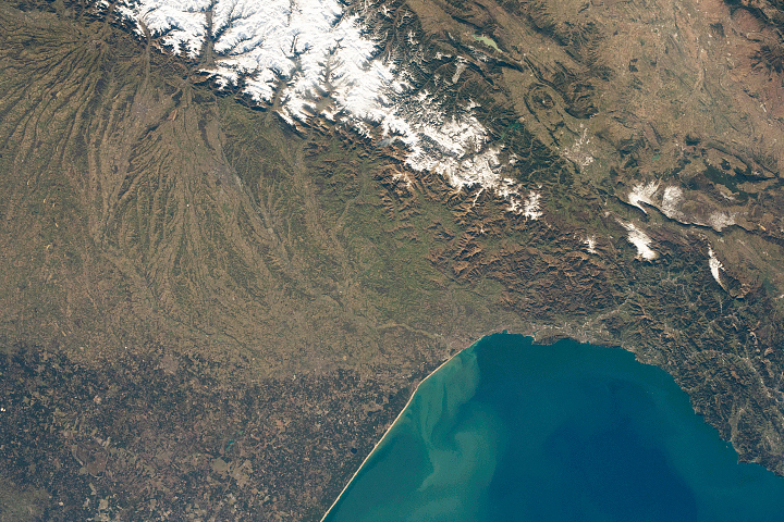
Like many glaciers around the world, this glacier in the Swiss Alps is shrinking.
Published Apr 1, 2019
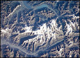
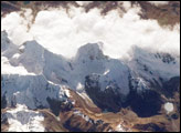
The formidable mountain system of the Alps stretches across much of central Europe, with seven countries claiming portions of the mountains within their borders: Germany, France, Switzerland, Italy, Liechtenstein, Austria, and Slovenia. The glacial landscape of the Bernese Alps, located in southwestern Switzerland, is well illustrated by this astronaut photograph. An astronaut took this picture looking north-northwest while the International Space Station was over the Mediterranean Sea between Corsica and Italy. Three of the higher peaks of the central Alps are visible: Jungfrau at 4,158 meters (13,642 feet); Moench at 4,089 meters (13,415 feet); and Eiger at 3,970 meters (13,025 feet).
Published Dec 11, 2006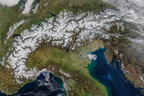
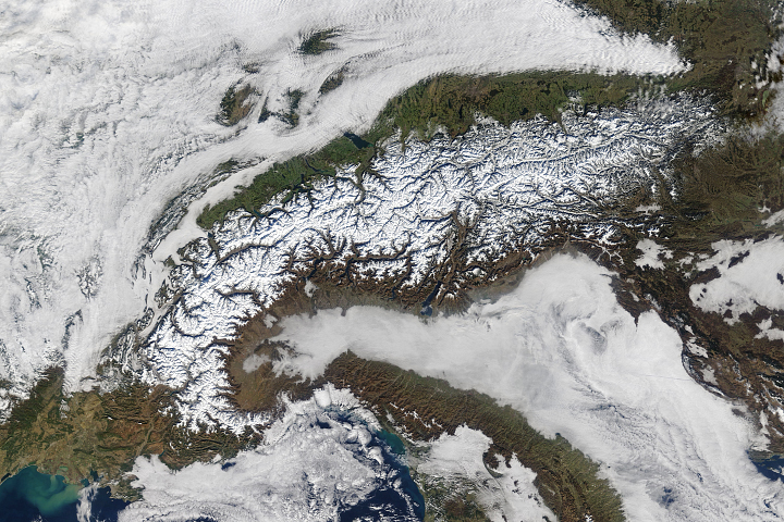
Late winter storms dropped a fresh coating of snow across the Alps in mid-March 2016.
Published Mar 27, 2016
Water, ice, and geological history have carved the landscape between Spain and France.
Published May 5, 2019

Satellite sensors help distinguish snow and ice from clouds and fog.
Published Feb 1, 2018Image of the Day Atmosphere Land Unique Imagery Snow and Ice Remote Sensing
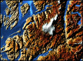
This astronaut photograph was taken looking east as the International Space Station was flying about 100 kilometers (about 62 miles) off the Peruvian coast and shows Cordillera Huayhuash (pronounced “Why-wash”).
Published Jul 21, 2008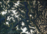
Over 300 glaciers, about one-third of the glaciers in the Lower 48 states, lie within the park boundaries.
Published May 7, 2006