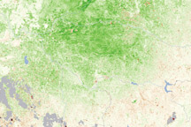
This vegetation map reveals that plants in southeastern Australia’s Wheatbelt were flourishing under abundant spring rains.
Published Dec 23, 2010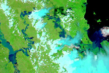
Rivers in Australia’s Fitzroy Basin are swollen in this false-color image acquired on January 4, 2011.
Published Jan 6, 2011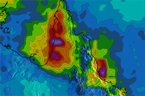
This color-coded map shows rainfall amounts over northeastern Australia from late February to late March 2012.
Published Mar 26, 2012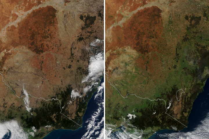
After two years of severe drought, abundant rain finally fell over the Australian state and turned the landscape green.
Published Jun 22, 2020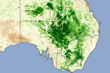
This vegetation image from March 2010 shows lush vegetation growing in Australia’s interior, where developing swarms of locusts had been spotted.
Published Apr 17, 2010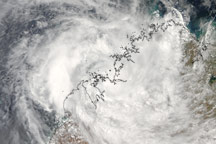
Tropical Cyclone Billy continued traveling along Western Australia's Kimberley Coast .
Published Dec 22, 2008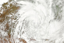
This image, from February 4, 2011, shows that ex-cyclone Yasi maintained its distinctive spiral shape after two days moving over Australia’s eastern coast and interior.
Published Feb 4, 2011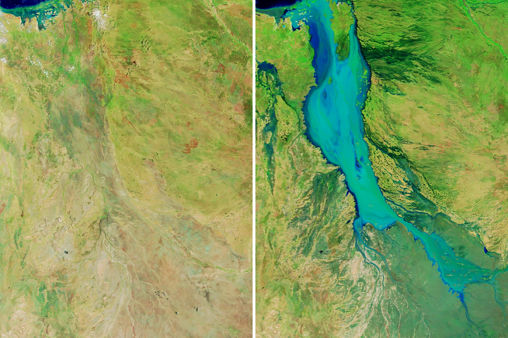
Weeks of rainfall pounded Queensland in January and February 2019, causing destructive flooding in the region.
Published Feb 11, 2019Image of the Day Atmosphere Land Water Floods Human Presence Remote Sensing
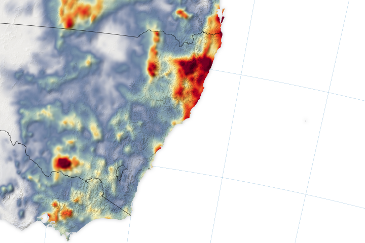
Bushfire counts dipped in mid-January when much-needed rainfall poured down on New South Wales and Victoria.
Published Jan 24, 2020Image of the Day Atmosphere Heat Land Unique Imagery Remote Sensing
A season of extremes in eastern Australia took another dramatic turn in mid-February 2020.
Published Feb 12, 2020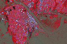
Though water levels had started to subside, the Australian city of Rockhampton was still inundated when this image was taken on January 7, 2011.
Published Jan 8, 2011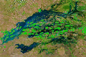
Flood waters swelled rivers along the Queensland-New South Wales border in early February 2013.
Published Feb 5, 2013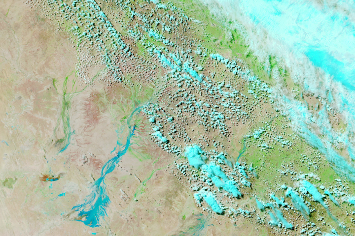
Weeks after rain fell in northern Queensland, floodwaters have traveled hundreds of kilometers to parched areas in the southwest of the state.
Published Mar 30, 2018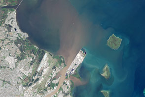
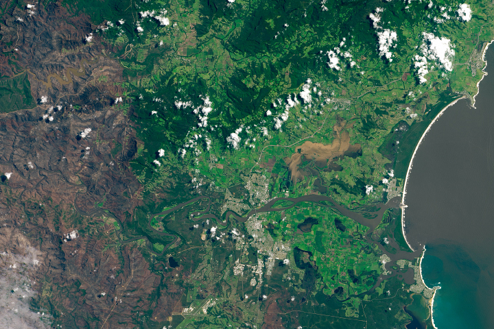
When the rainstorm ended in southeast Australia, a brown plume emerged from the Brisbane River.
Published May 6, 2015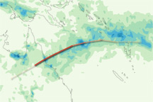
This color-coded map shows rainfall amounts associated with Tropical Cyclone Yasi from January 28 to February 3, 2011.
Published Feb 4, 2011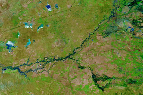
Flood waters continued flowing downstream in New South Wales in mid-December 2011.
Published Dec 15, 2011