Acquired February 5, 2011, this natural-color image shows sediment suspended along the Queensland coast, near the city of Townsville.
Published Feb 7, 2011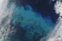
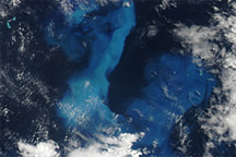
Streaks of brilliant blue water over Australia’s Great Barrier Reef in this true-color image reveals some of Cyclone Yasi’s impact on the ocean.
Published Feb 4, 2011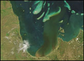
In late February 2007, NASA satellite images revealed that even the outer portions of the Australia’s Great Barrier Reef can be bathed in land-based pollution carried far offshore by plumes of river water. Conventional thinking was that river plumes affected only the lagoon and the inner portions of the reef. But images from the Moderate Resolution Imaging Spectroradiometer (MODIS) on NASA’s Terra satellite verify a new theory that not even the outer reefs are spared the impact of land-based pollution, which includes excess sediment, fertilizers, and pesticides.
Published Mar 29, 2007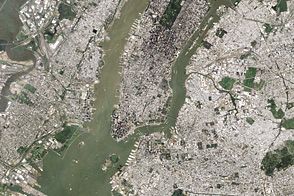
In the wake of Hurricane Irene’s heavy rains, sediment filled the Hudson River and New York Harbor.
Published Sep 2, 2011
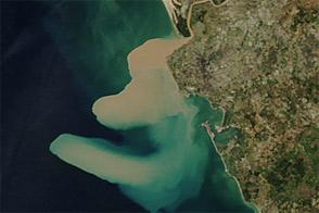
Tropical Cyclone Rusty left flood conditions along the coast of northwestern Australia in early March 2013.
Published Mar 5, 2013
The potent storm has discolored the Gulf of Mexico near Florida and Alabama.
Published Oct 15, 2018
Acquired January 9 and 25, 2011, these natural-color images she flood waters slowly receding in the city of Rockhampton, Queensland, Australia.
Published Jan 30, 2011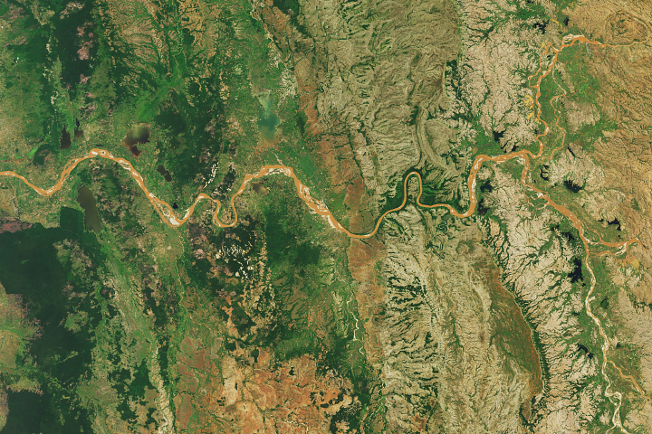
Gullies in the highlands called lavakas are a major source of sediment.
Published Feb 10, 2018
Terra gives a broad view of the scale of the devastating flooding.
Published Sep 2, 2017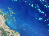

Acquired November 12 and 13, 2012, these images show a sediment plume along Spain’s southwestern coast.
Published Nov 18, 2012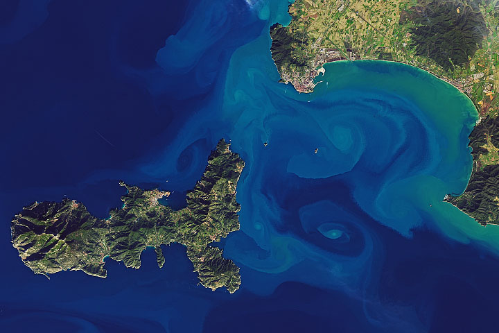
Natural-color satellite images can capture art-like beauty when sediments trace water currents and eddies; other kinds of data can make that art intersect with scientific understanding.
Published Feb 1, 2020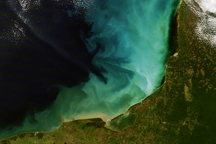
A burst of color lit the shallow waters of the Gulf of Mexico off the Yucatan Peninsula on December 14, 2008.
Published Jan 3, 2009