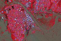
Though water levels had started to subside, the Australian city of Rockhampton was still inundated when this image was taken on January 7, 2011.
Published Jan 8, 2011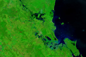
The city of Rockhampton is bracing for major flooding.
Published Apr 4, 2017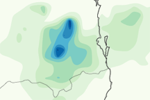
This rainfall map shows the concentrated area of intense rain that led to devastating flash flooding in Queensland, Australia, on January 10, 2011.
Published Jan 12, 2011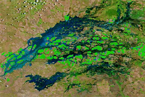
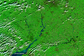
Flood waters swelled rivers along the Queensland-New South Wales border in early February 2013.
Published Feb 5, 2013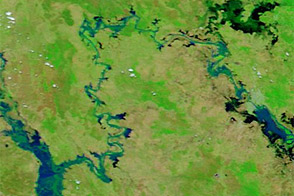
Acquired January 17 and 30, 2013, these images compare conditions along the Mackenzie-Fitzroy River system.
Published Jan 31, 2013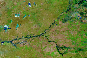
Flood waters continued flowing downstream in New South Wales in mid-December 2011.
Published Dec 15, 2011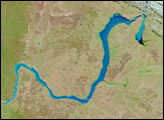
A series of rainstorms pushed rivers in southern Great Britain to flood stage in February 2014.
Published Feb 17, 2014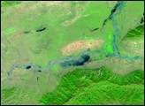
Relentless rains are to blame for ongoing flooding in northeastern China. On September 1, 2003, embankments along the Weihe river, left, burst.
Published Oct 23, 2003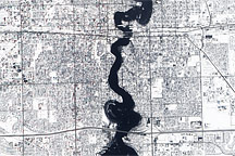
Held in place by reinforced levees, the swollen Red River snakes through Fargo, North Dakota, and Moorhead, Minnesota, in this image captured by the Advanced Land Imager on the EO-1 satellite on March 28, 2009.
Published Mar 31, 2009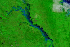
Acquired in late March 2012 and 2011, these images compare conditions along the Isaac River, a tributary of Queensland’s Fitzroy River.
Published Mar 29, 2012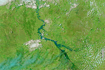
Acquired December 6 and November 6, 2010, these false-color images show conditions before and after heavy rains filled seasonal rivers in Queensland.
Published Dec 6, 2010