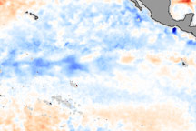
La Niña is an occurrence of unusually cold water temperatures in the Pacific Ocean along the equator (the precise area affected is outlined in black in the image above). La Niña and its opposite, El Niño, are linked to seesaw variations in air pressure over the tropical Pacific and affect weather patterns across the globe. NASA monitors developing El Ni&ntidle;o and La Niña events by observing sea surface temperatures. This image compares the water temperatures observed in late January 2006 to long-term average conditions for that time of year. The recent data were collected by the Advanced Microwave Scanning Radiometer for EOS (AMSR-E). Red shows where sea surface temperatures are warmer than normal and blue where they are colder than normal.
Published Feb 9, 2006
La Niña, the large area of cold water in the Pacific Ocean widely blamed for last summer's drought and often related to an increase in the number of hurricanes that make landfall, appears to be on its last legs.
Published May 10, 2000
With its own forms of underwater weather, the ocean has fronts and circulation patterns that move heat and nutrients around its basins. Changes near the surface often start with changes in the depths.
Published Mar 21, 2017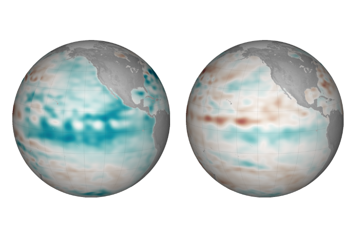
Cooler than normal conditions prevail in the central and eastern Pacific, but the event is so far considered weak.
Published Dec 22, 2017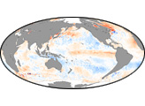

A strip of cold water hugging the equator in the eastern tropical Pacific Ocean in mid-June may foreshadow a transition from El Niño to La Niña conditions
Published Jun 24, 2010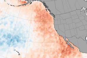
Temperature anomalies in the eastern Pacific Ocean are both influencing and being influenced by unusual weather patterns. The effects are rippling through the marine environment.
Published Apr 18, 2015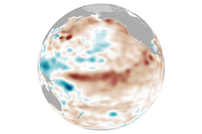
Ocean conditions are not likely to help drought-stressed regions this spring. However, some broader changes might be coming in the Pacific.
Published Mar 25, 2015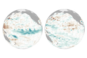
The near-record water temperatures of 2015-16 has been followed by a modest, quiet appearance of La Niña.
Published Jan 6, 2017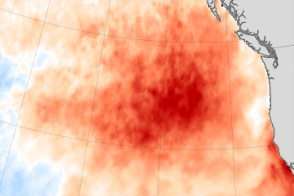
After changing regional weather patterns and taking a bite out of sea life, an unusually persistent patch of warm water in the northeastern Pacific has chilled out.
Published Feb 16, 2016
For many people, El Niño and La Niña mean floods or drought, but the events are actually a warming or cooling of the eastern Pacific Ocean that impacts rainfall. These sea surface temperature and rainfall anomaly images show the direct correlation between ocean temperatures and rainfall during El Niño and La Niña events.
Published Oct 24, 2009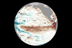
Conditions in May 2014 look similar to those in May 1997, a year that brought one of the most potent El Niño events of the 20th century.
Published May 14, 2014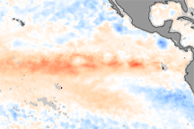
These color-coded images show the strengthening of El Niño between October and November 2009. In the November image, warm waters (indicated in red) have spread across the Pacific.
Published Dec 11, 2009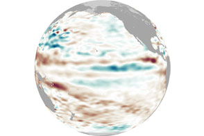
After appearing for two consecutive winters, La Niña appears to be taking some time off.
Published May 4, 2012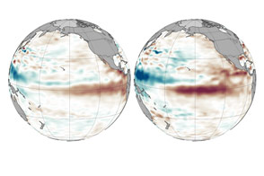
Weakening trade winds are allowing warm water to move east across the Pacific in a telltale pattern.
Published Aug 5, 2015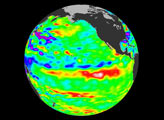
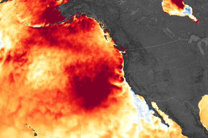
The warm surface water this summer was caused by an unusual and persistent weather pattern.
Published Sep 13, 2019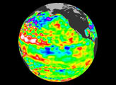

Acquired September 6, 2010, this map shows cooling in the central Pacific Ocean consistent with La Niña conditions.
Published Sep 19, 2010