After decades of decline, satellites show mangrove forests are covering more area and growing more densely in this West African country.
Published Mar 21, 2018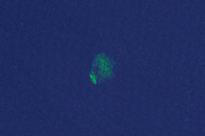
Researchers have turned to citizen scientists to help detect previously unknown or recently disrupted kelp forests in satellite imagery.
Published Jan 13, 2015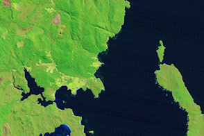
Potent storms and pesky predators—as well as climate change—are altering the dynamics of these underwater forests.
Published Jan 20, 2015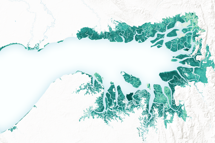
Mangrove forests are among the planet’s best carbon scrubbers.
Published Feb 27, 2019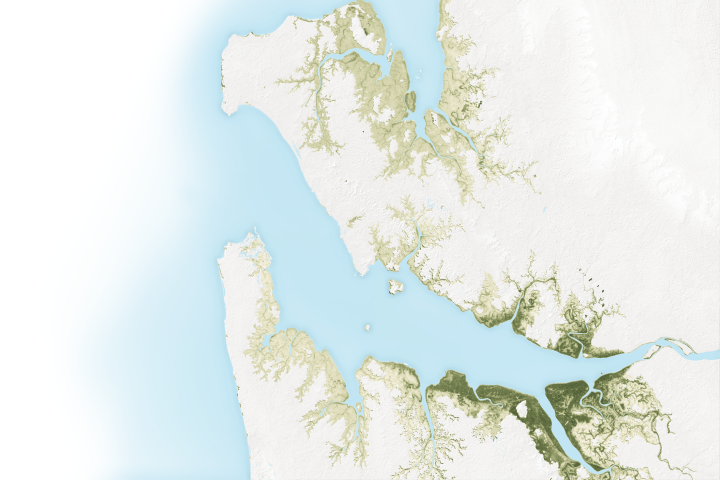
The mangroves in Pongara National Park are among the tallest in the world, towering up to 60 meters.
Published May 19, 2017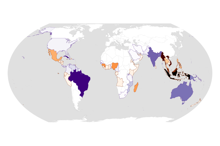
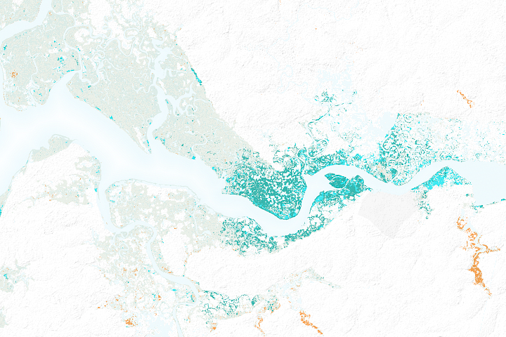
While the rate of losses has declined, the ecosystems are still threatened and are facing more environmental stress.
Published Aug 25, 2020Image of the Day Land Life Water Human Presence Remote Sensing
Kelp forests change frequently, and often out of sight from scientists. Infrared imagery changes that.
Published Jan 6, 2015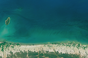
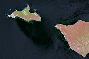
Record-high temperatures and reduced rainfall have decimated the trees and shrubs along the northern coast.
Published Aug 10, 2016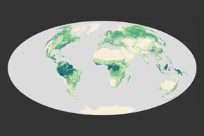
A high-resolution map offers a global view of forest canopy heights.
Published Apr 13, 2012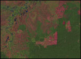
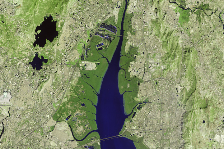
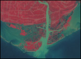
Satellites offer some needed perspective on the status of vulnerable mangrove forests along the Indian city’s many waterways.
Published Nov 30, 2017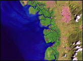
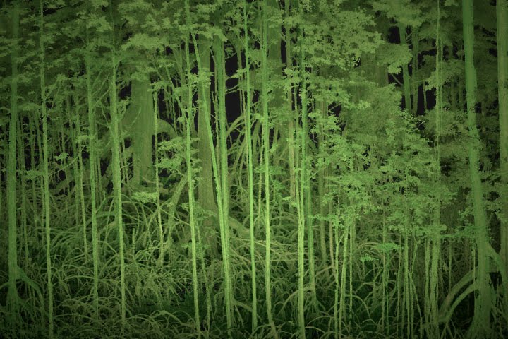
Scientists use lasers and cameras to characterize the 3D structure of mangrove forests in Gabon.
Published Jun 1, 2017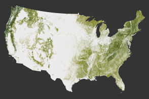
The National Biomass and Carbon Dataset reveals the location and the carbon storage of forests in the United States.
Published Jan 11, 2012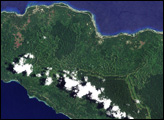
In June 2008, scientists published the country’s first detailed assessment of the type, extent, and health of Papua New Guinea’s forests, documenting the wide-spread deforestation and degradation of lowland rainforest on the islands east of the mainland, including the island of New Ireland.
Published Jun 19, 2008
Forests in drylands are much more extensive than previously reported.
Published Aug 10, 2017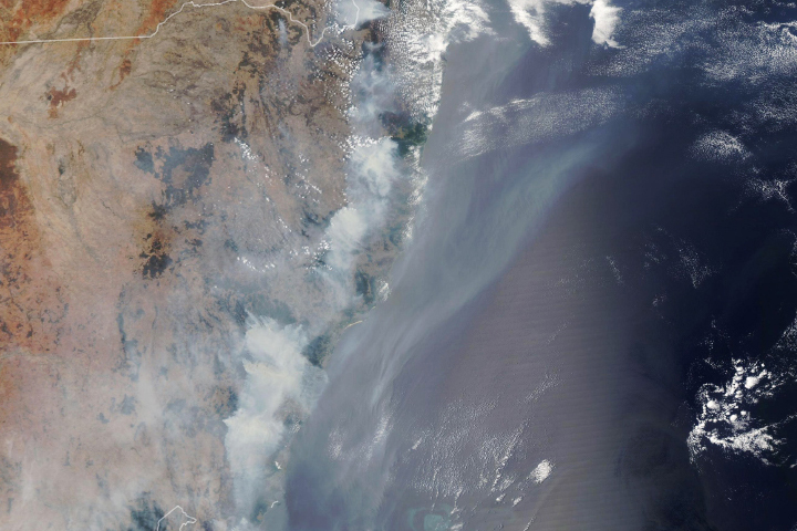
Blazes that have raged since October have charred eucalyptus and rainforests in New South Wales.
Published Dec 12, 2019
Open-access data from the NASA-USGS Landsat mission and cloud computing make for a highly detailed view of gains and losses in global and regional tree cover since 2000.
Published Nov 16, 2013
New maps show an estimate of the carbon stored in tropical forests and how sure scientists are about those estimates.
Published Jan 18, 2012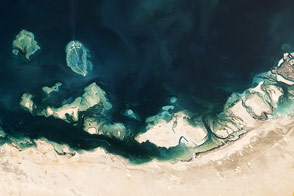
The United Arab Emirates coast is home to complex assortment of natural features.
Published Apr 13, 2013
What does Landsat have in common with the Gutenberg Bible, Tolstoy’s personal library, and the Book of Kells?
Published Nov 24, 2011