Acquired on May 23, 2010, this natural-color image shows the Colorado Plateau’s Rainbow Bridge, a natural sandstone arch, casting a slim shadow to the northwest.
Published May 30, 2010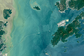
Once completed, the Hong Kong-Zhuhai-Macau Bridge will be one of the longest water crossings in the world.
Published May 15, 2016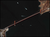

The Golden Gate of San Francisco Bay is one of the most recognizable straits in the world due to the Golden Gate Bridge that spans it. This high-resolution astronaut photograph is a nearly cloud-free view of the northern part of the San Francisco metropolitan area.
Published Sep 4, 2006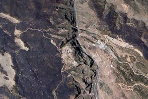
In June 2013, a wildfire devastated the area around Royal Gorge in Colorado. However, one of the world's highest suspension bridges survived with only minor damage.
Published Jul 16, 2013
Man and nature have both altered the course of a southwestern U.S. river.
Published May 21, 2012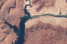
In the early twenty-first century, Lake Powell faced the combined threats of drought and rapid water withdrawals.
Published May 13, 2009
Parts of the Glen Canyon that John Wesley Powell explored in 1869 have been submerged by Lake Powell.
Published Oct 16, 2016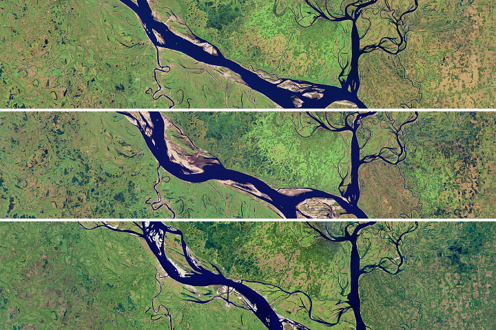
The lower portion of the Padma River has wide meandering curves, an indicator of extensive erosion.
Published Aug 28, 2018
In August 2010, Lake Mead reached its lowest level since 1956, the result of a persistent drought and increasing human demand.
Published Sep 23, 2010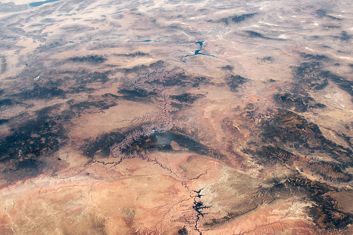
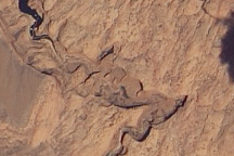
Ancient geologic features and modern creations share the spotlight in this photo of southeastern Utah and northern Arizona taken from the ISS.
Published Feb 23, 2020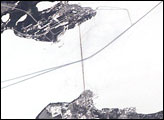
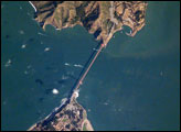
he Mackinac Bridge spans a stretch of water five miles wide between Michigan’s lower and upper peninsulas. The strait connects Lakes Michigan (left) and Huron (right). The bridge is a combination of pier-supported spans with a high, central suspension sector that allows passage of lake steamers.
Published Apr 25, 2005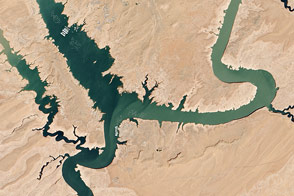
In spring 2014, visitors to Lake Powell will find beaches and rock formations that are usually underwater. After several years of drought, the reservoir has dropped below 50 percent capacity.
Published May 22, 2014