Unlike the vegetated tundra of its neighboring islands, Bunge Land is a barren sandy plain that also serves as a land bridge.
Published Oct 5, 2020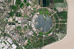
Seawalls and dredging have created new real estate along the city’s coastlines.
Published Mar 31, 2017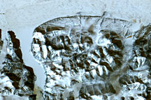
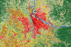
Satellites help land managers and city planners track city growth and ecosystem health around Portland, Oregon.
Published Aug 2, 2012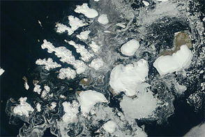
Acquired August 17, 2011, this natural-color image shows Franz Josef Land, a 191-island archipelago in the northeastern Barents Sea.
Published Aug 28, 2011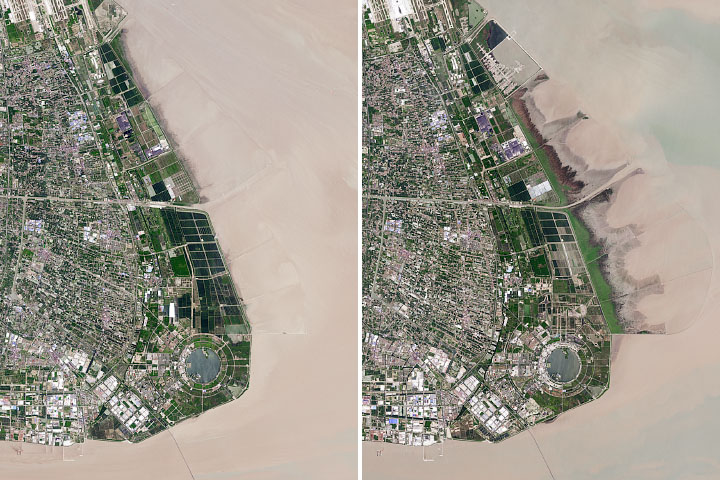
The Chinese city has reclaimed land from shallow coastal waters at a rapid rate.
Published Dec 11, 2019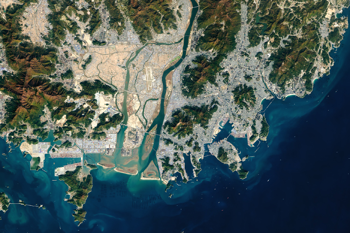
The South Korean port is among the busiest in the world.
Published Sep 5, 2018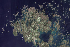
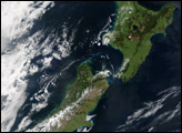
This summertime, natural-color image shows the Åland Islands between Sweden and Finland.
Published Sep 20, 2011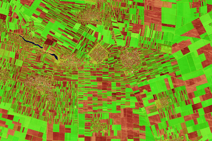
Farms in the historic Oltenia province display a compelling array of shapes and sizes.
Published Oct 14, 2020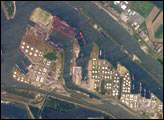
The Port of Rotterdam, also known as Europoort (Eurogate), has been an important trading center since approximately AD 1250. The history of the port reflects the evolution of the world’s economic base. Originally serving the North Sea herring fleets, it rapidly grew into a major mercantile port during the Dutch colonial period. The 19th century witnessed the Industrial Revolution, and steel and coal became major commodities passing through the port. Following the development of petroleum as a primary energy resource in the early 20th century, the port expanded westward to accommodate storage facilities and large oil tankers.
Published Jun 20, 2005
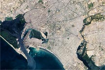
Acquired January 8, 2010, this true-color image shows part of Karachi, Pakistan, a city of over 12 million residents. Heavily urbanized areas mix with rivers and mangroves, especially near the Port of Karachi.
Published Feb 5, 2010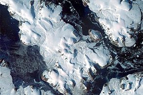
This late summertime shot captures sea ice and land ice in Russia’s northernmost territory.
Published Jan 7, 2012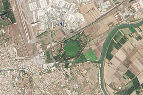
The distinctive, hexagon-shaped Trajanic Basin marks the spot of one of the Roman Empire’s great engineering achievement.
Published Mar 15, 2015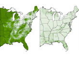
A series of maps showing land use in 1850 and 1920.
Published Feb 9, 2008