The northernmost arm of Antarctica is a hotspot of research because its retreating glaciers are a large contributor to sea level rise.
Published Feb 24, 2017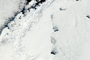
The MODIS instrument on NASA’s Aqua satellite captured this clear view of the Antarctic Peninsula, the Larsen Ice Shelf, and the sea ice covered waters around the region in October 2011.
Published Oct 15, 2011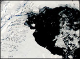
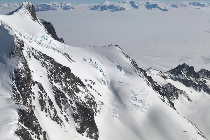
Approaching the icy continent by aircraft, the vast expanse of water and ice is suddenly broken by gray and brown rocky mountaintops
Published Dec 28, 2017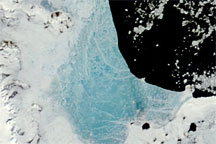
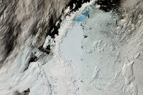
Changing weather conditions left their mark on sea ice along the Antarctic Peninsula in late 2008 and early 2009. In mid-December 2008, melt water resting on the sea ice colored it sky blue. At the beginning of 2009, however, the sea ice appeared snowy white, and cracks had begun along the ice margin.
Published Jan 9, 2009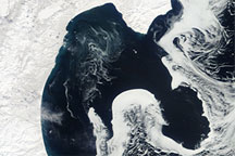
Acquired April 13, 2010, this natural-color image shows a long formation of sea ice with a shape that mimics the features of the eastern shore of the Kamchatka Peninsula.
Published Apr 15, 2010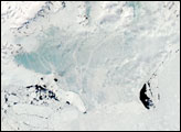
The tip of the Antarctic Peninsula showed dramatic seasonal changes in late January 2008. On January 24, 2008, the fast ice looked solidly frozen. Several days later, on January 30, 2008, the ice’s new blue hue suggested something had changed.
Published Feb 6, 2008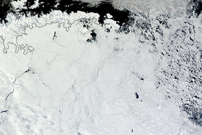
Winds pushed Antarctic sea ice north of its typical location in February 2013.
Published Mar 1, 2013
New elevation measurements will give researchers an unprecedented understanding of the thickness of sea ice, which will be used to help improve climate modeling and forecasts.
Published Dec 18, 2018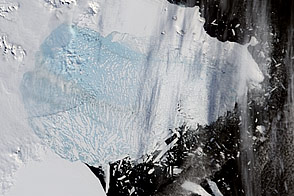
Moderate-resolution Imaging Spectroradiometer (MODIS) satellite imagery analyzed at the University of Colorado’s National Snow and Ice Data Center revealed that the northern section of the Larsen B ice shelf, a large floating ice mass on the eastern side of the Antarctic Peninsula, has shattered and separated from the continent. This particular image was taken on March 5, 2002.
Published Mar 20, 2002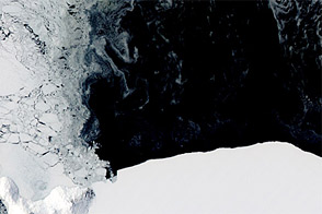
In some places where ice should cover the sea, open water appears instead.
Published Nov 22, 2011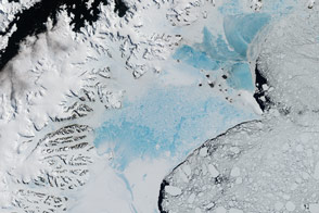
When this closely watched slab of floating ice births a giant iceberg, it will not be the first time it has seen dramatic change.
Published Feb 7, 2017Image of the Day Heat Land Water Snow and Ice Sea and Lake Ice
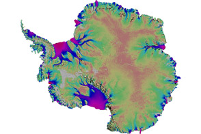
Scientists mapped the motion of Antarctica’s ice sheets and revealed unexpected patterns.
Published Aug 19, 2011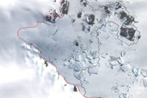
This image shows the latest estimate of the ice edge around Law Promontory, which juts out from East Antarctica’s coastline near Stefansson Bay.
Published Jul 23, 2010