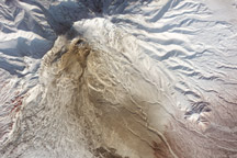
This satellite image shows the remnants of a large pyroclastic flow on the slopes of Shiveluch Volcano.
Published Mar 1, 2011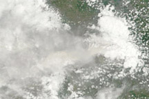
The eruption of Merapi Volcano continues after almost two weeks of nearly constant activity.
Published Nov 8, 2010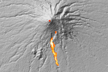
This visualization shows the approximate location of an avalanche of hot ash and volcanic gas flowing down Indonesia’s erupting Mount Merapi volcano on October 30, 2010.
Published Nov 5, 2010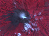
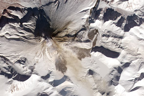
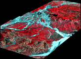
Widespread deposits of volcanic debris from frequent pyroclastic flows drape the slopes of Kizimen Volcano.
Published Mar 29, 2013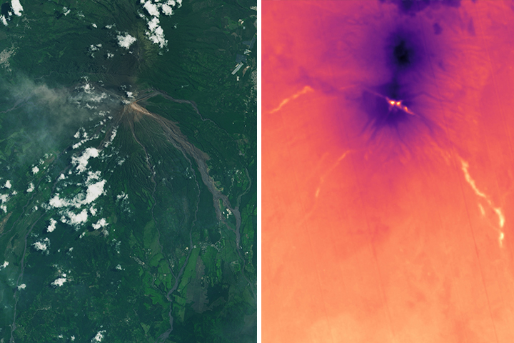
A jumble of hot ash, rock, and soil poured down the slopes of the Guatemalan volcano in early June. Weeks later, satellites continued to detect elevated temperatures in the thick deposits.
Published Jun 27, 2018Image of the Day Heat Land Volcanoes Human Presence Remote Sensing
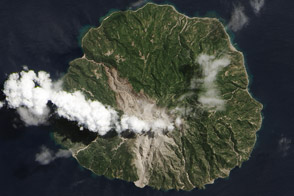
A fresh scar on the north side of this Indonesian volcanic island reveals the flow of hot ash and rock.
Published Sep 7, 2013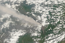
A thick plume of ash rose from Mount Merapi on November 10, 2010, when this photo-like image was taken. It is the most cloud-free image of the eruption to date.
Published Nov 11, 2010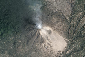
On February 1, 2014, fifteen people were killed when hot debris from this Indonesian volcano engulfed the village of Sukameriah.
Published Feb 12, 2014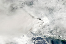
Signs of the eruption at Mount Merapi managed to punctuate the persistent cloud cover over Java on November 5, 2010.
Published Nov 6, 2010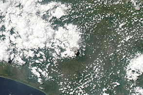
Indonesia’s Mount Merapi exhibited a short-lived increase in activity on March 27, 2014.
Published Mar 31, 2014