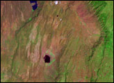
The landscape of the Afar region in northern Ethiopia results from tectonic forces working deep below the surface, both splitting Africa apart and producing volcanic eruptions. Lava from a November 2008 eruption at the Erta Ale Range remained visible months later.
Published Feb 4, 2009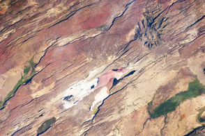
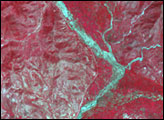
It is one of the great tectonic features of Africa—caused by fracturing of the Earth’s crust—and includes the classical geologic structures associated with a rift valley.
Published Apr 2, 2012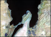
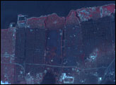
The lowest spot on dry land, the Dead Sea depression sinks 400 meters (1,300 feet) below sea level.
Published Nov 12, 2006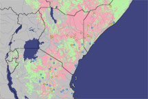
Using satellite data, scientists predicted an outbreak of Rift Valley fever in East Africa months before the first human cases were reported. The early prediction gave governments time to mitigate the spread of the disease.
Published Feb 15, 2009
The city of Las Cruces is located within the Rio Grande Rift, a large geological feature that extends from Colorado southwards into Mexico. The Rio Grande Rift is marked by a series of depressions punctuated with uplifted mountains. Sinking in one place is often accompanied by uplift along boundaries of the grabens—the striking Organ Mountains to the east of Las Cruces are one such uplifted fault block.
Published Jul 4, 2005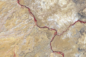
Acquired June 11, 2001, this false-color image shows the arid region where Utah, Colorado, New Mexico, and Arizona meet.
Published Sep 25, 2011