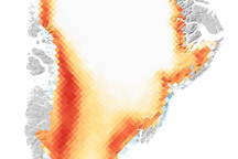
The ice-covered island’s melt season lasted 50 days longer than average.
Published Feb 18, 2011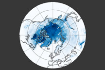
Snow and ice play an important role in keeping our planet cool, though not in the way you might think.
Published May 19, 2011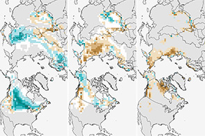
The climate of Earth is changing; fewer days of snow cover is yet another indicator.
Published Jan 3, 2014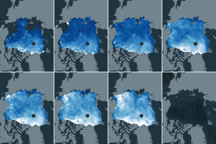
First-of-a-kind maps show how the depth of this insulating snow layer changes from month to month.
Published May 27, 2020
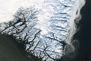
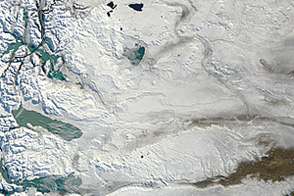
Captured near the end of 2012, this image shows a mixture of sea ice, land ice, and fresh snow.
Published Jan 6, 2013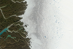
Melting of the Greenland Ice Sheet reveals impurity-rich ice that is thousands of years old.
Published Oct 28, 2014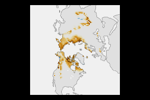
High-latitude springtime snow cover declined substantially between 1967 and 2012.
Published Jan 8, 2013
This satellite map of snow cover shows that every state in the contiguous U.S., except for Florida, received snow in January 2011.
Published Feb 25, 2011
Melt ponds on the surface of Greenland’s ice sheet are an important indicator of the strength of the 2013 melt season.
Published Jul 9, 2013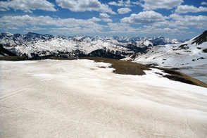
Scientist Tom Painter examines the differences between pure and dirty snow. A rise in dust can be a critical influence on snow-fed water supplies in the American West.
Published Sep 1, 2013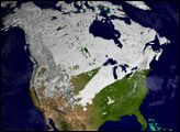
Acquired May 30, 2012, this natural-color image shows snow cover across southern South America.
Published May 31, 2012