Acquired September 18, 2010, this natural-color image shows extensive flooding along the northeastern margin of Manchhar Lake in Pakistan.
Published Sep 23, 2010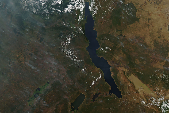
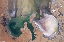
Long and short. Deep and shallow. Salty and fresh. Blue and brown. These are Africa’s Lake Tanganyika and Lake Rukwa.
Published Jun 20, 2019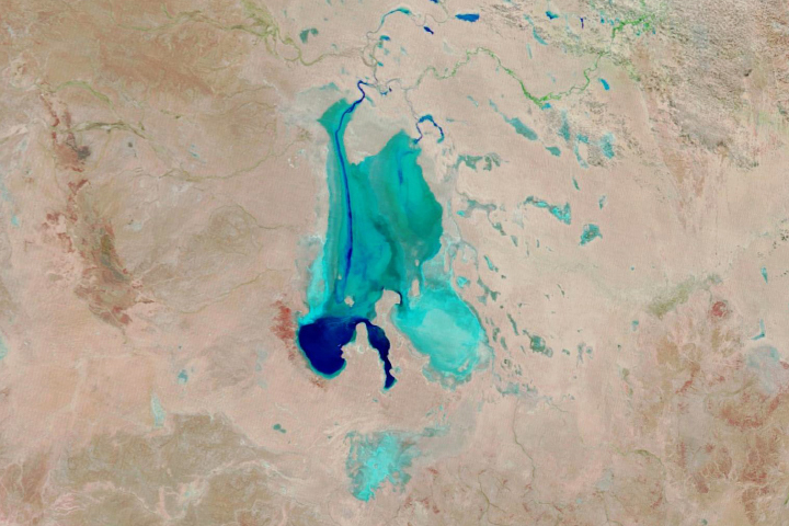
Floodwaters have worked their way through a series of parched channels, watering holes, and lagoons to start filling the iconic Australian lake.
Published May 28, 2019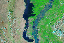
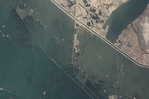
Acquired September 7, 2010, and September 13, 2010, these false-color images show floodwaters rising along a massive lake that branched off the Indus River.
Published Sep 13, 2010
By mid-June 2009, the rare filling of this lake in Australia’s Simpson Desert appeared to have reached its peak.
Published Jun 21, 2009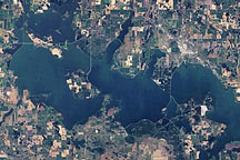
Acquired on August 11, 1984 (top), and September 1, 2009 (bottom), these true-color images show dramatic expansion of Devils Lake in North Dakota. In the 1990s, the lake began flooding, spilling into neighboring Stump Lake.
Published Feb 14, 2010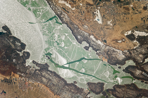
Straddling Austria and Hungary, the lake is also known as the “Sea of the Viennese.”
Published Apr 10, 2017
In May 2016, the reservoir behind Hoover Dam reached its lowest level since the 1930s.
Published May 27, 2016
Surging with fresh water from heavy winter snow melt, Lake Powell rose significantly in the summer of 2011 after many years of low levels.
Published Aug 12, 2011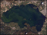
Lago de Valencia (Lake Valencia) is located in north-central Venezuela and is the largest freshwater lake in the country. The lake was formed approximately 2-3 million years ago due to faulting and subsequent damming of the Valencia River. The lake has been completely dry during several discrete periods of its geologic history. Since 1976 Lake Valencia water levels have risen due to diversion of water from neighboring watersheds—it currently acts as a reservoir for the surrounding urban centers (such as Maracay).
Published Nov 22, 2004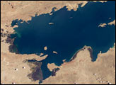
Lake Titicaca, at an elevation of 12,507 feet (3,812 meters) in the Andean Altiplano, is the highest large lake in the world. More than 120 miles long and 50 miles wide, it was the center of the Incan civilization, and today straddles the boundary between Peru and Bolivia.
Published Dec 22, 2003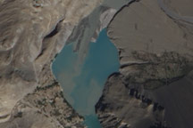
Acquired October 3, 2010, this natural-color images show slight changes in a landslide lake along the Hunza River in northwestern Pakistan.
Published Oct 13, 2010
In August 2010, Lake Mead reached its lowest level since 1956, the result of a persistent drought and increasing human demand.
Published Sep 23, 2010