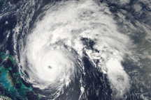
Hurricane Earl is a well-formed storm east of the Bahamas in this true-color image from September 1, 2010.
Published Sep 1, 2010
Satellites and astronauts observed the potent storm as it headed for landfall in the southeastern United States.
Published Sep 12, 2018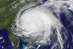
Irene, the first hurricane of the 2011 Atlantic season, was poised on August 26 to be the first to make land-fall in tU.S. since 2008. More than 50 million people were estimated to lie within the path of the storm.
Published Aug 27, 2011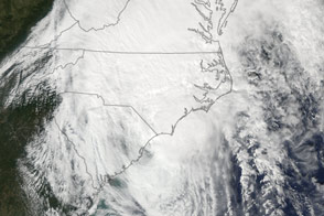
The Aqua satellite captured this image of Matthew as the storm churned along the coast of South Carolina.
Published Oct 8, 2016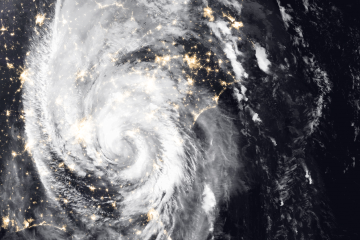
Since making landfall, the storm has caused severe property damage and deaths in the southeastern United States, with more damage expected.
Published Oct 11, 2018Image of the Day Atmosphere Land Severe Storms Human Presence

The powerful hurricane is believed to be the strongest on record to hit the northwestern Bahamas.
Published Sep 1, 2019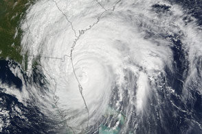
Hurricane Matthew closed in on the Atlantic coast after devastating Haiti earlier this week. The storm’s western eyewall brushed parts of Florida.
Published Oct 7, 2016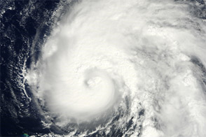
Acquired September 29, 2011, this natural-color image shows Ophelia east-northeast of Puerto Rico.
Published Sep 30, 2011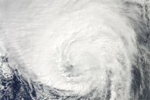
Acquired August 29, 2010, this natural-color image shows Hurricane Danielle over the Atlantic Ocean.
Published Aug 30, 2010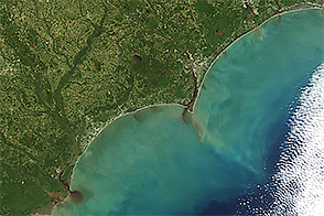
When the Terra satellite captured this image, floodwater was spilling into the Atlantic Ocean.
Published Oct 11, 2016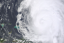
This image shows Hurricane Earl north of Puerto Rico on August 31, 2010.
Published Sep 1, 2010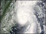
The fierce storm was just hours from passing over Bermuda when a NASA satellite captured this view.
Published Oct 17, 2014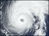
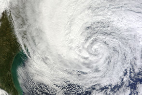
As the U.S. East Coast prepared for landfall of the potent storm, Sandy churned up the Atlantic Ocean along the Gulf Stream.
Published Oct 28, 2012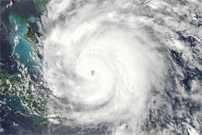
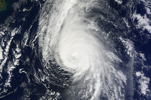
Acquired at 2:15 p.m. EDT on August 24, 2011, this natural-color image shows Hurricane Irene over the Caribbean, en route to the continental United States.
Published Aug 25, 2011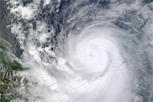
Acquired September 16, 2010, this natural-color image shows Hurricane Karl over the Gulf of Mexico and southern Mecixo.
Published Sep 17, 2010