A high-resolution map offers a global view of forest canopy heights.
Published Apr 13, 2012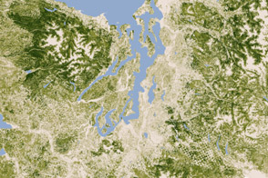
A new map of the biomass in the United States allows scientists and land managers to see tree cover down to the scale of individual plots of land.
Published Feb 17, 2012
By changing a percentage, institutions can take some forested lands off the map.
Published Dec 18, 2015
Differences in how international and national institutions classify forests can lead to large discrepancies in measurements of land cover.
Published Nov 17, 2015
New maps show an estimate of the carbon stored in tropical forests and how sure scientists are about those estimates.
Published Jan 18, 2012
Forests in drylands are much more extensive than previously reported.
Published Aug 10, 2017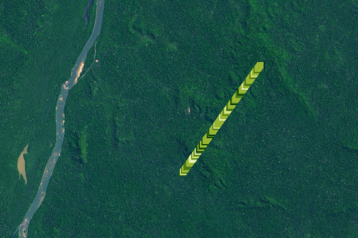
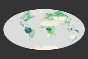
The amount of carbon that is being stored by trees and how it has changed over time is the least understood aspect of the global carbon cycle.
Published Jan 27, 2020
The opening of the Landsat data archive and a partnership with Google has allowed researchers to track the fine details of forest change around the world.
Published May 7, 2015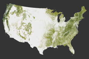
The National Biomass and Carbon Dataset reveals the location and the carbon storage of forests in the United States.
Published Jan 11, 2012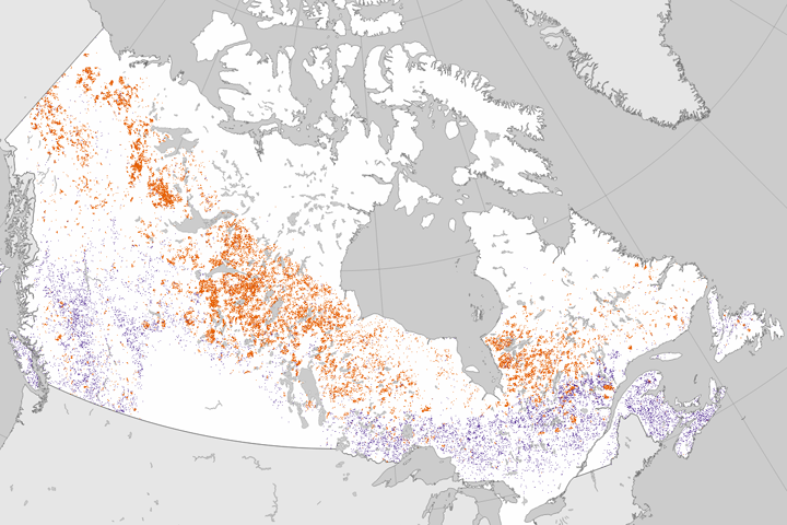
Researchers analyzed 25 years of Landsat data to establish where forests had burned or been cut.
Published Jun 27, 2017
Since the mid-1200s, the state has controlled Niepołomice Forest, which contains some of the last pockets of old-growth forest in Poland.
Published Nov 29, 2013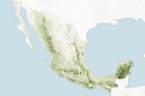
Mapping the density and location of tree cover can help the nation reduce deforestation and offset carbon emissions.
Published Nov 5, 2015
Wildfires make a significant mark on the bird’s nesting and roosting habitat.
Published Dec 23, 2019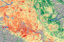
As the size of British Columbia’s pine beetle infestation has grown, forest managers have begun to need a technique to identify damage over large areas. Relying on a variety of data sources, including satellite data, scientists from Goddard Space Flight Center conducted a survey of insect-damaged forests in British Columbia. This image shows their assessment of insect damage overlain on a topography map.
Published Dec 19, 2008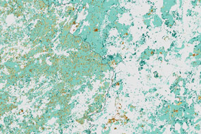
Political change in Eastern Europe and Russia has left its mark on forests in the region.
Published Jul 16, 2015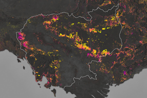
Forests are being turned into rubber plantations, farmland, and timber at a rapid rate.
Published Jan 10, 2017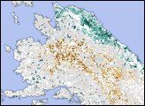
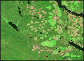
In British Columbia’s Coast Mountains, some 200 kilometers (125 miles) inland from the Pacific Ocean, rivers and lakes cut tortuous paths through rugged terrain. The peaks and valleys in this region are covered with forest, but the forest has changed over the years due to human use and insect pests, in particular, the mountain pine beetle.
Published Oct 12, 2008
A small plane flying low over remote forests is sending back eye-popping aerial photography—as well as scientific measurements that will improve understanding of how Alaska’s forests are responding to global warming.
Published Jul 25, 2014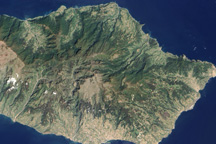
The deep green forest that covers the northern mountains of Madeira Island is one of the last remnants of an ancient forest that once covered much of Europe and North Africa.
Published May 15, 2010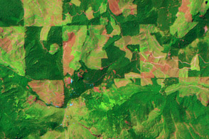
This pair of images show patterns of forest clearing and regrowth in Wasghington state over 26 years. Such images help scientists understand how human decisions impact the carbon cycle and Earth’s climate.
Published Jul 5, 2011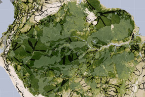
Researchers studying tropical forests have mapped out a way to preserve significant amounts of carbon-rich vegetation and biodiversity by connecting existing protected areas.
Published Apr 2, 2014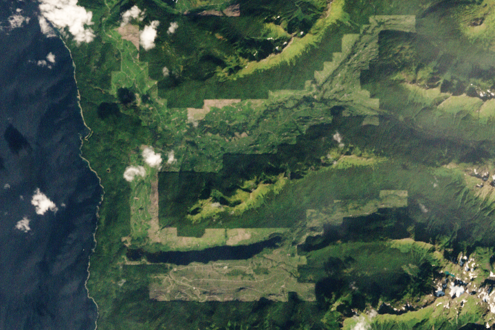
Brown bears abound on this Alaskan island, parts of which have seen both widespread clear-cutting and forest regrowth in recent decades.
Published Apr 24, 2020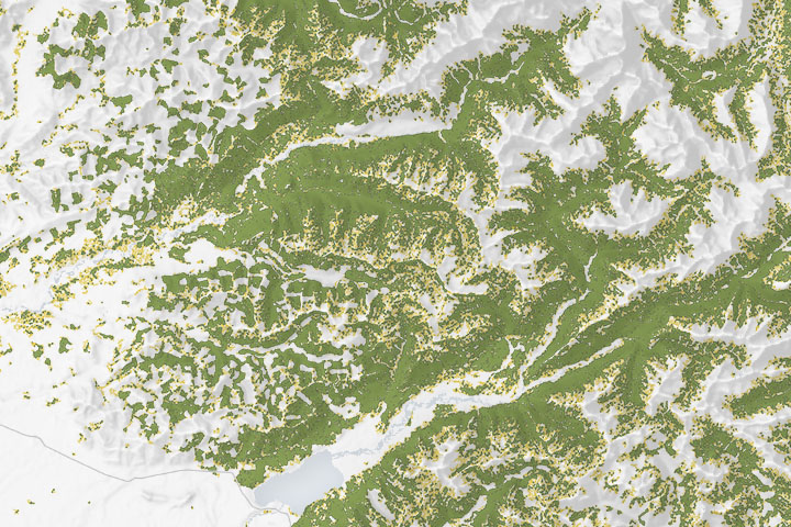
Maps of forest cover type show where the composition and structure of the forest is sufficient for the threatened species to nest and roost.
Published Dec 18, 2019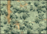
In recent decades, industrial logging has intensified in the dense tropical forests of central Africa, but few data sets exist that can help ecologists and policymakers monitor the occurrence and impact of logging over wide areas in that part of the world.
Published Jul 5, 2007