This color-coded map shows the rainfall and storm track associated with Hurricane Karl from September 14 to 18, 2010.
Published Sep 24, 2010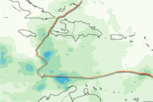
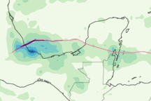
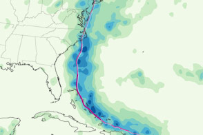
This color-coded image shows rainfall over the Caribbean from November 1 to 7, 2010, and the storm track for Tomas from October 30 to November 7, 2010.
Published Nov 8, 2010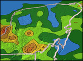
This color-coded map shows the storm track and rainfall totals associated with Hurricane Irene from August 22 to 28, 2011.
Published Aug 30, 2011
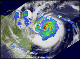
Acquired June 26, 2010, this image shows color-coded precipitation amounts superimposed on a natural-color image of Alex.
Published Jun 28, 2010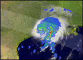
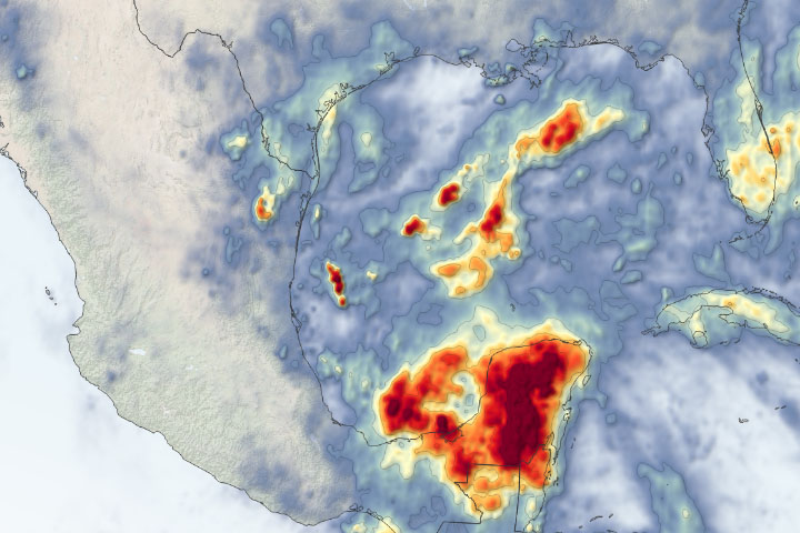
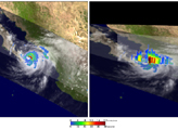
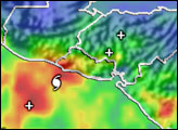
The storm lingered over the Yucatán Peninsula for several days.
Published Jun 5, 2020Image of the Day Atmosphere Land Water Severe Storms Human Presence Remote Sensing